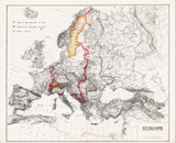
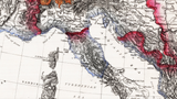
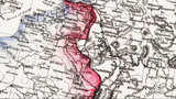


European Theater of Operations Color Map from 1944-1945
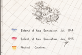
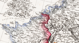
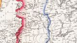
This map shows the front lines in January 1944 and again in January 1945. Color coded to show the large swath of territory the Germans lost on the Western front (Allies went from no territory to approaching the Rhine) and in the East where the Germans were pushed back hundreds of miles. Italy also shows significant changes as the Allied armies drove North.
Created/Published: 1945
Dimensions (Width x Height): 32x26.4
Each map is printed using the finest materials and methods. Your map will be handled with white gloves from start to finish. We use the Giclee printing method on Hahnemuhle paper, which produces a clear, extremely detailed, durable map that is perfect to be proudly displayed in your home or office.
Digital watermark does not appear on your purchased map.


