Iwo Jima Hand Drawn Assault Battle Map with Regiments
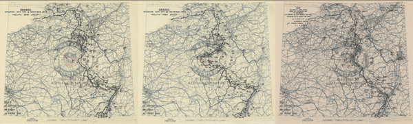
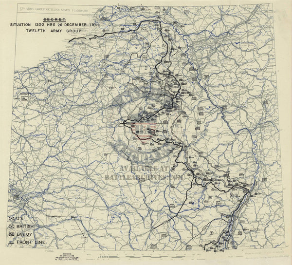
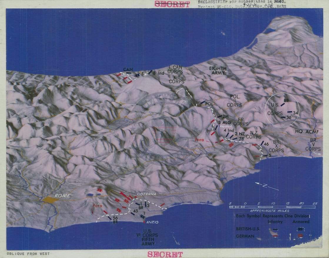
The Battle of Iwo Jima was fought from 19 February to 26 March 1945 in the Volcano Islands (more broadly the Bonin Islands), about 750 miles (1,200 kilometers) south of Tokyo. The battle was fought entirely by the US Marines and Navy. Iwo Jima has the distinction of causing more casualties for the Americans than the Japanese. Iwo Jima has been immortalized as Joe Rosenthal took one of the most famous pictures in the history of the world, "Raising the Flag on Iwo Jima."
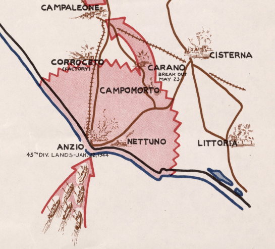
This hand drawing shows the amphibious assault route taken to the beach and then the route across the island towards complete victory. Note the Marine regiments are shown where their amphibious landings took place. Also shown is the location of the USS Bismarck Sea, which was sunk in 21 February and the last American carrier to be sunk during the war.
Result: American Victory
Created/Published: 1945
Dimensions (Width x Height): 25.7x24
Our printing is archive-quality.
Each map is printed using the finest materials and methods. Your map will be handled with white gloves from start to finish. We use the Giclee printing method on the finest paper, which produces a clear, extremely detailed, durable map that is perfect to be proudly displayed in your home or office.
About our framing:
- Non-glare acrylic to reduce reflection
- Dry mount to ensure your map is smooth and without wrinkles
- 1.5 inch, 4-ply white mat to accentuate your map
- Black, light walnut, and natural frame color options to match any room
- Wire mounting
- Please note that we cannot refund or return custom framed maps. We can replace a damaged frame. If your frame is damaged, please use the Contact Us or email customercare@battlearchives.com
Digital watermark does not appear on your purchased map