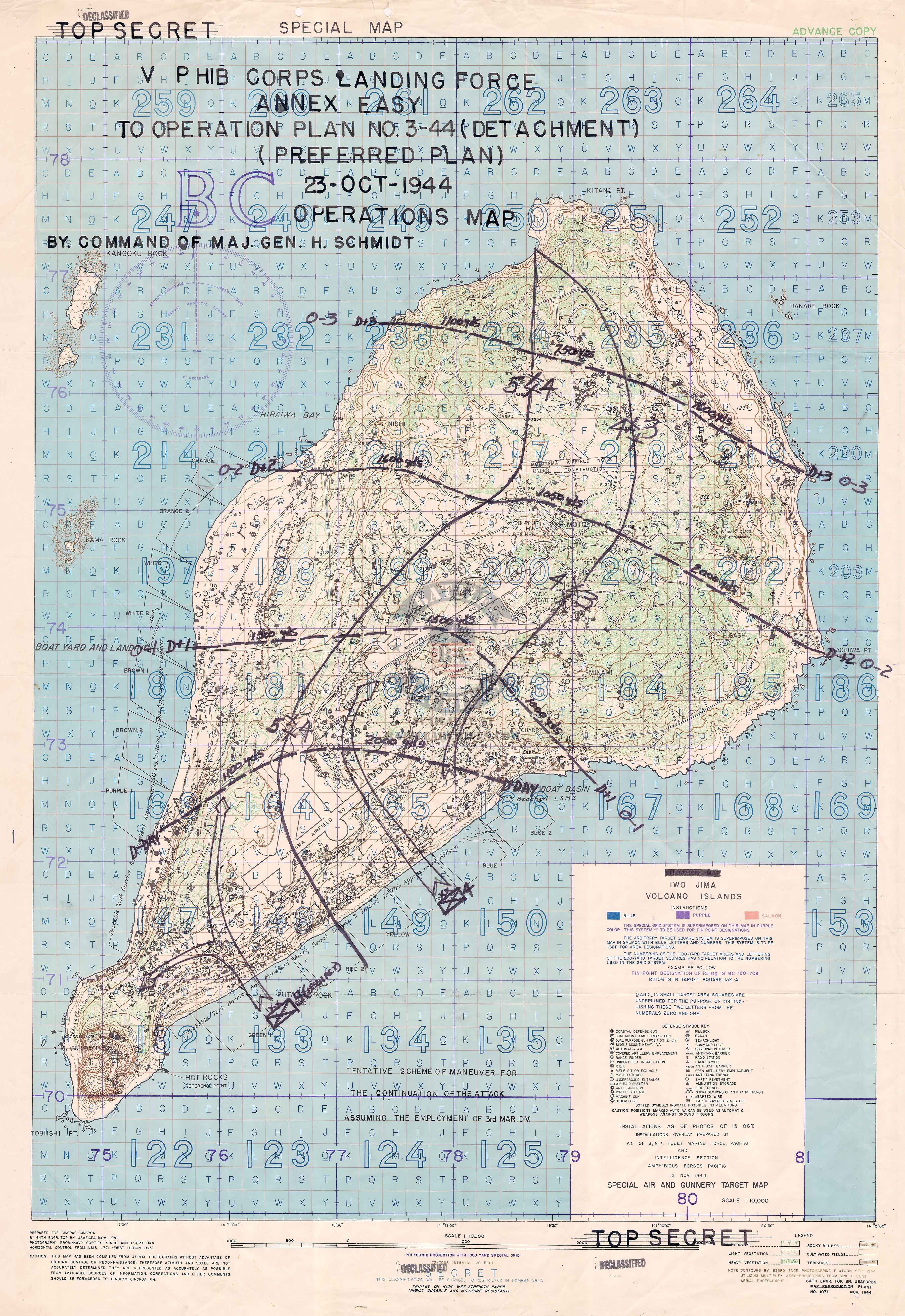
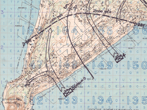
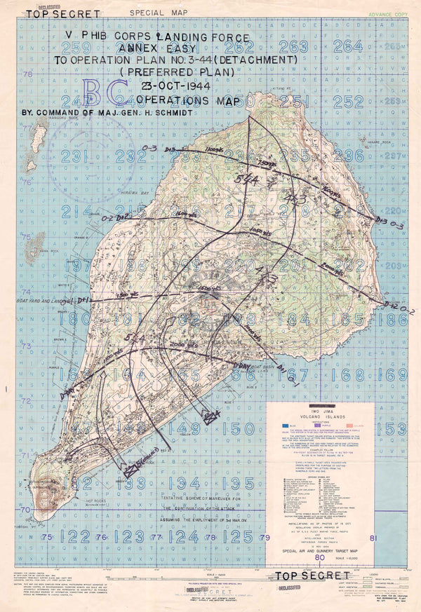
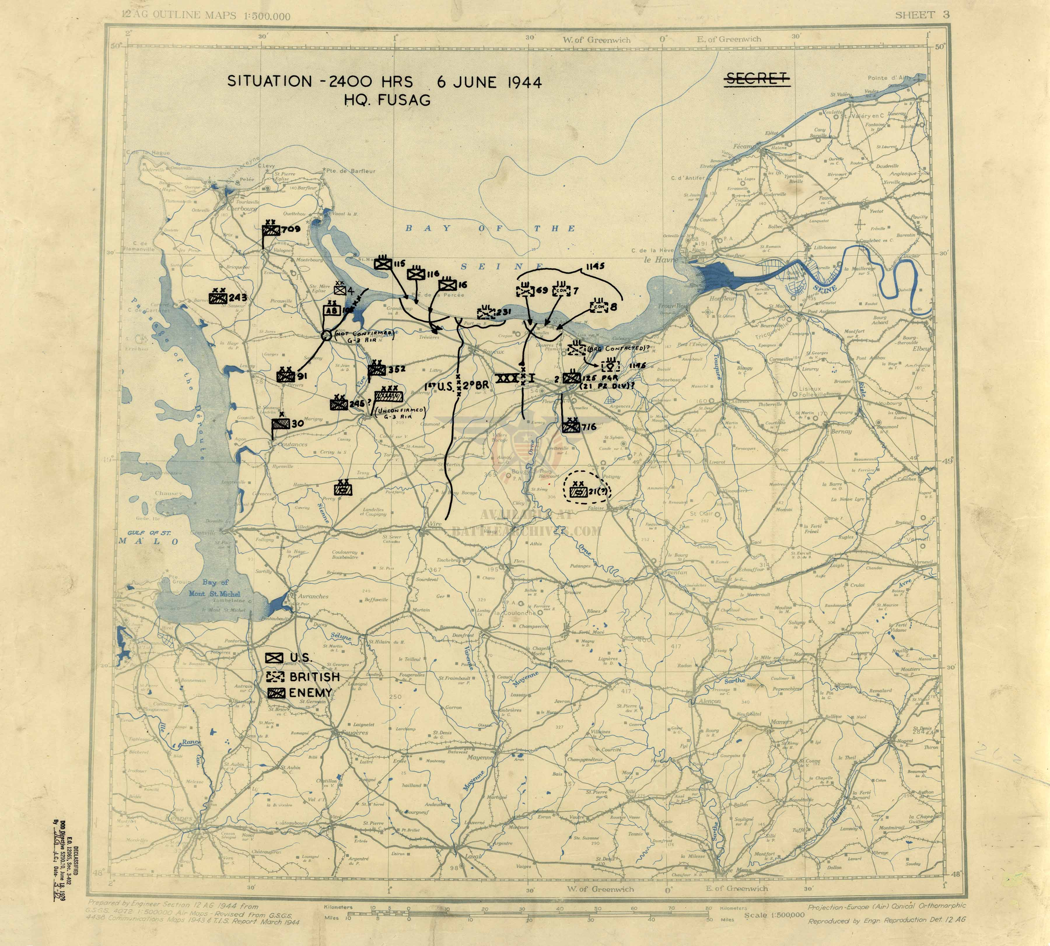
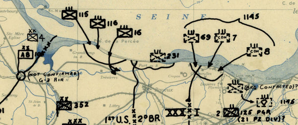
Okinawa Landing Beaches Battle Map
The Battle of Okinawa (Operation Iceberg) was fought from April to June, 1945. The amphibious landings at the outset of the battle was the largest amphibious assault of the Pacific War. Okinawa was the last stop on the Allied island hopping campaign before getting to the Japanese main islands. The US took over 50,000 casualties in the battle.
This Marine Corps map shows the landing plans for the beaches on 1 April and the regiments involved in the landings.
Result: American Victory
Published: 1945 (most likely)
Dimensions (Inches, Width x Height): Multiple sizes
Each map is printed using the finest materials and methods. Your map will be handled with white gloves from start to finish. We use the Giclee printing method on Hahnemuhle paper, which produces a clear, extremely detailed, durable map that is perfect to be proudly displayed in your home or office.
Digital watermark does not appear on your purchased map.