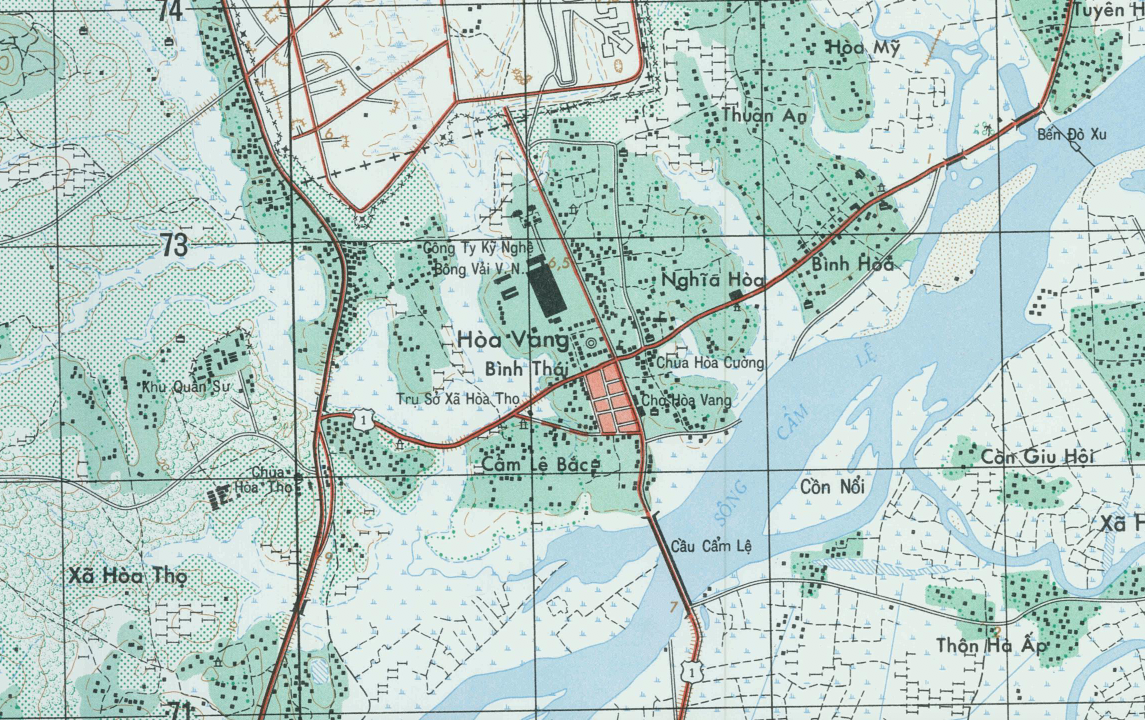
Da Nang, Vietnam – 1967 Topographical Map (1:25,000)
Da Nang, Vietnam – 1967 Topographical Map (1:25,000)
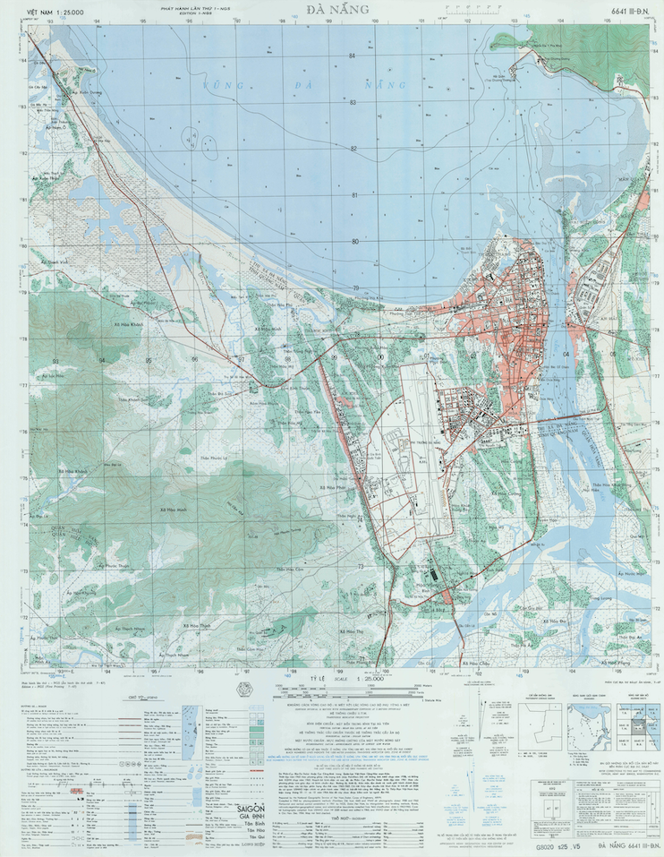
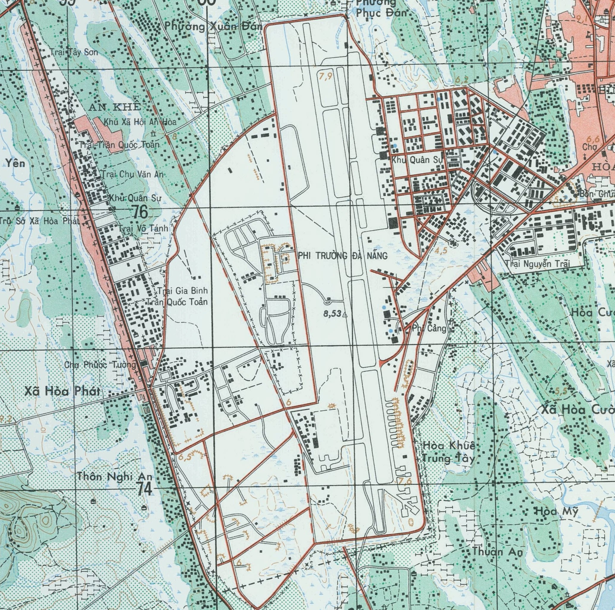
Da Nang Air Base was one of the largest and most strategically significant air installations supporting the war in Vietnam. Army, Air Force, and Marine aviation units were all stationed at Da Nang, with American forces beginning to arrive as early as 1962. For many U.S. servicemen, Da Nang was their first step onto Vietnamese soil. This detailed 1967 topographical map captures the air base, surrounding city, coastline, and terrain during a critical period of expansion and operational buildup.
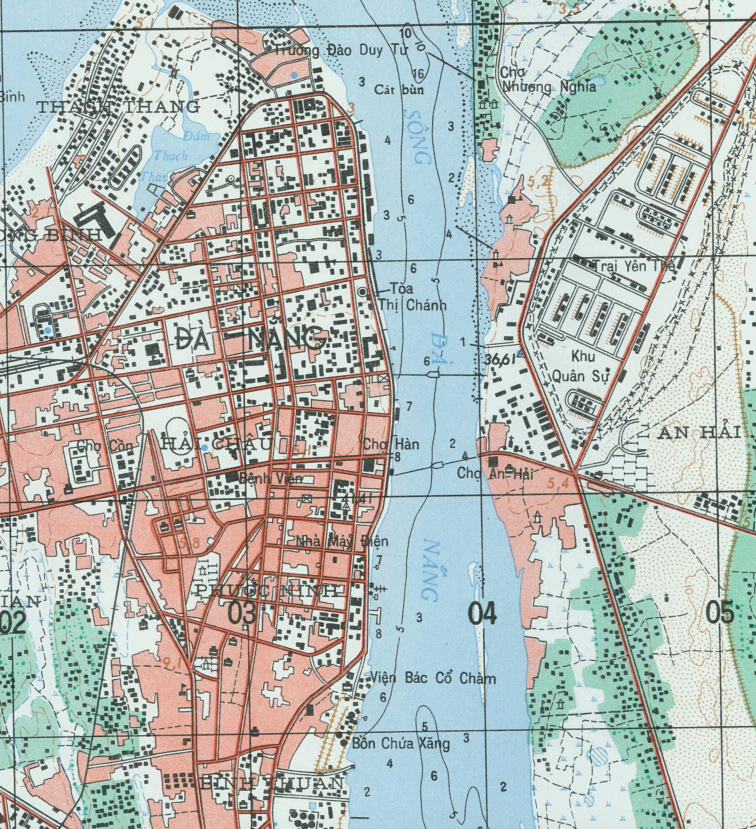
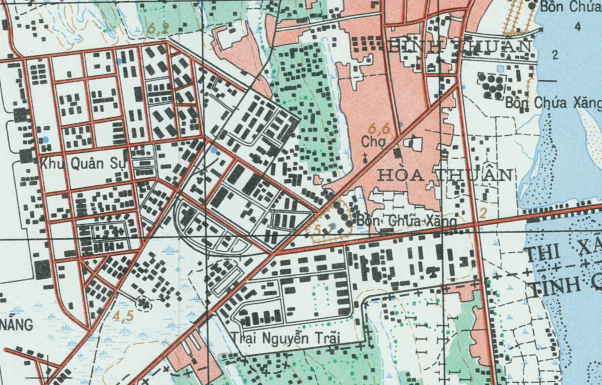
Historical Context By 1967, Da Nang had evolved into a major hub for air and ground operations in I Corps Tactical Zone. As U.S. troop levels increased, the air base expanded rapidly to support combat sorties, transport missions, reconnaissance flights, and medical evacuations. The city and its surrounding infrastructure grew alongside the military presence, making this period one of intense development and strategic importance.
The Map’s Features This large-scale military topographical map (1:25,000) provides detailed contour lines, road networks, waterways, urban districts, coastline features, and base infrastructure. Compared to the 1:12,500 version, this edition offers a broader operational view of Da Nang and its surrounding terrain, illustrating both the airfield complex and the expanding urban environment.
Historical Significance As one of the primary operational centers in northern South Vietnam, Da Nang played a central role in sustaining American and allied strategy. This map preserves a geographic snapshot of the area during a pivotal year of the conflict, documenting both military infrastructure and the terrain that shaped operations.
Museum-Quality Reproduction This is a high-quality reproduction of the original 1967 topographical map, professionally printed on archival Hahnemühle paper using the Giclée printing process to preserve fine cartographic detail, line clarity, and period accuracy for long-term display.
Perfect For:
• Vietnam War veterans and military families
• Aviation and military history enthusiasts
• Collectors of Vietnam-era military cartography
• Offices, studies, and veteran memorial spaces
• Gifts honoring service in Southeast Asia
Specifications:
• Original Publication: 1967
• Scale: 1:25,000
• Style: Military topographical installation map
• Battle/Conflict: Vietnam War
• Product Type: High-Quality Reproduction Print
Dimensions (Width x Height): 22.5 x 29
Each map is printed using the finest materials and methods. Your map will be handled with white gloves from start to finish. We use the Giclée printing method on Hahnemühle paper, which produces a clear, extremely detailed, durable map perfect for proud display in your home or office.
Choose options
