

Fort Sumter, Charleston Harbor, South Carolina – April 12–13, 1861 Bombardment Hand-Drawn Battle Map
Fort Sumter, Charleston Harbor, South Carolina – April 12–13, 1861 Bombardment Hand-Drawn Battle Map
This hand-drawn and hand-colored map of Charleston Harbor documents the Confederate encirclement and bombardment of Fort Sumter on April 12–13, 1861—the opening engagement of the American Civil War. Rendered with cartographic precision and field-sketch immediacy, the map traces the red lines of fire converging from every Confederate battery position in the harbor onto the solitary Union garrison occupying the man-made island at its center. Fort Sumter fell to Confederate forces on April 13, 1861, after a 34-hour bombardment, and remained under Confederate control for nearly four years until the collapse of Southern coastal defenses in February 1865. No comparable map in the Fort Sumter record combines the tactical detail of a military diagram with the visual character of a period field illustration.
Historical Context When Confederate General P.G.T. Beauregard's ultimatum demanding evacuation was refused by Union Major Robert Anderson, Confederate batteries opened a coordinated bombardment from no fewer than ten prepared positions ringing Charleston Harbor. The Confederate strategy required no infantry assault—a disciplined encirclement of artillery emplacements on Morris Island, James Island, Sullivan's Island, and the harbor's interior shoals ensured that Fort Sumter could be reduced by sustained fire alone. Anderson's garrison of fewer than 90 men faced a ring of columbiads, mortars, iron-clad floating batteries, and rifled guns that had been positioned and fortified over months of methodical preparation. The engagement produced no combat fatalities on either side, but its political consequences were total: within days, President Lincoln called up 75,000 militia, and the Union and Confederacy moved irreversibly toward four years of attrition warfare that would claim over 600,000 lives.
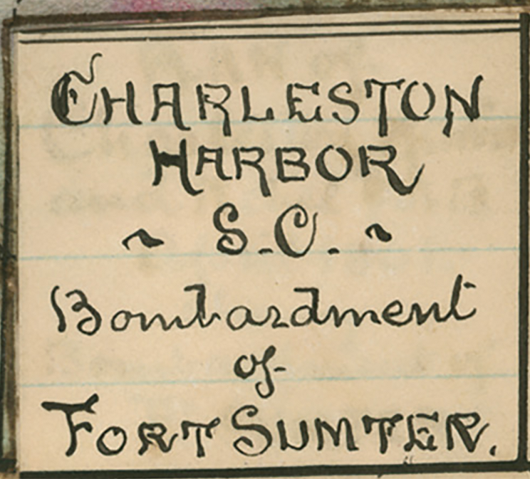
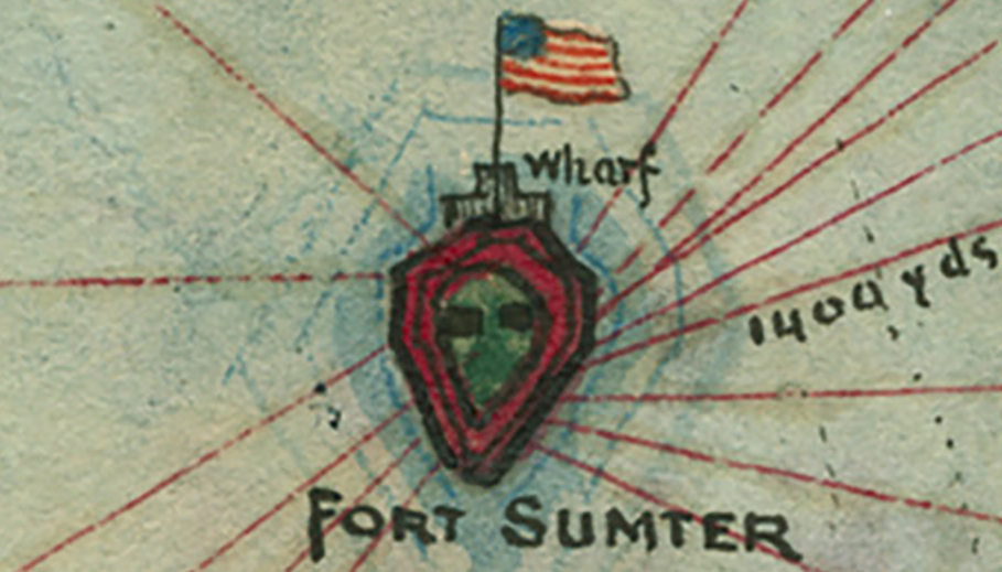
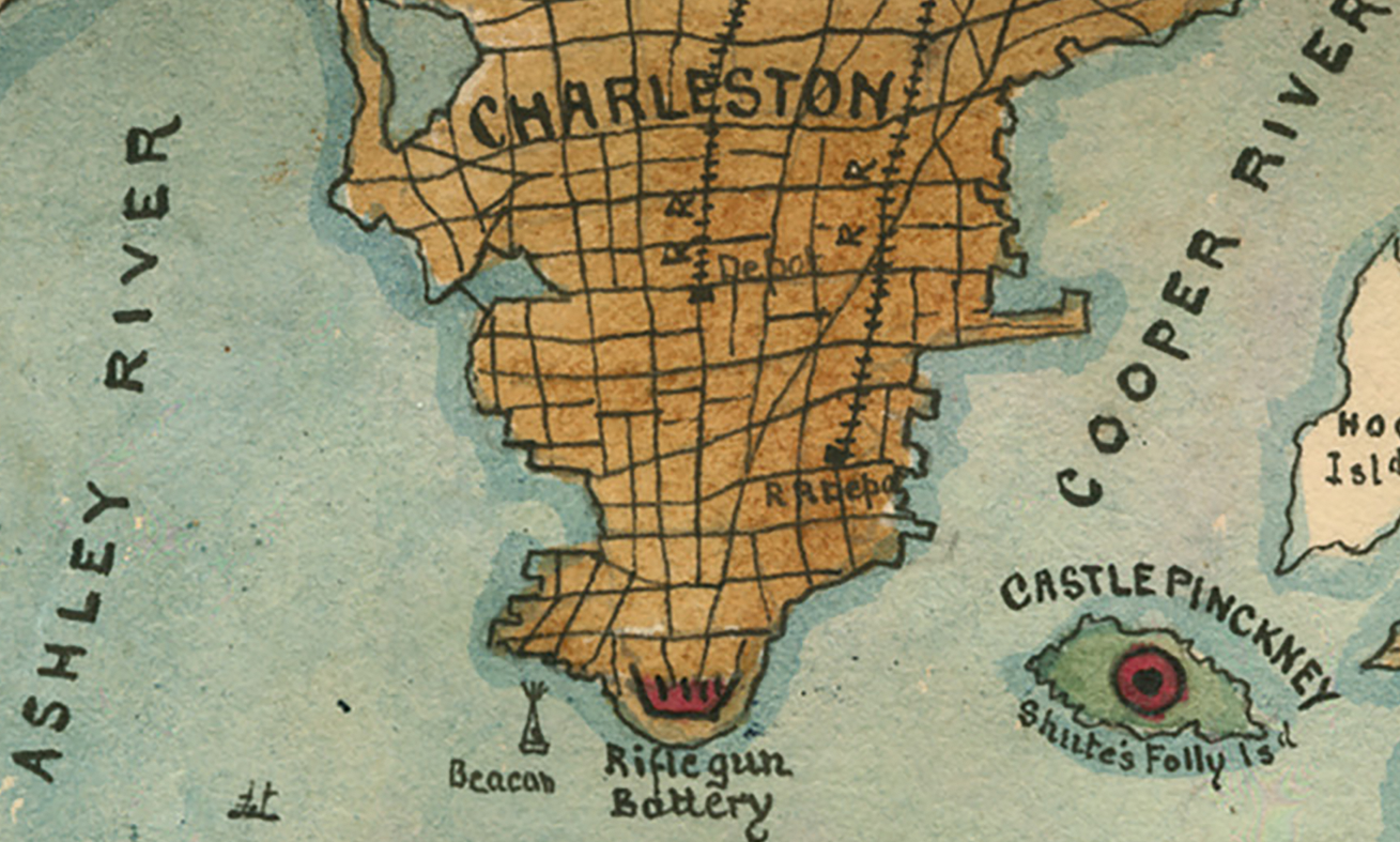
The Map's Features Centered on Fort Sumter—marked with a Union flag and rendered as a fortified shield symbol—the map deploys bold red lines of fire radiating outward to each labeled Confederate battery position, providing an immediate visual accounting of the encirclement. Distance notations, including a marked 1,400-yard measurement along the Ship Channel, allow the viewer to assess the effective ranges at which Confederate ordnance was delivered. Individual battery positions are identified by name across all quadrants: Cummings Point, Steven's Battery, Trapier's Battery, and Battery Gregg on Morris Island to the southwest; Fort Moultrie, the Iron Clad Floating Battery, Oblique Battery, Sumter Battery, Battery Beauregard, Enfilade Battery, and Dahlgren Battery along Sullivan's Island to the east; Fort Johnson's Upper and Lower Batteries on James Island to the west. The city of Charleston appears at the top with its street grid rendered in amber wash, while Castle Pinckney, Mount Pleasant, the Ashley and Cooper Rivers, and the Atlantic Ocean establish the full geographic theater. A formal cartouche in the lower right identifies the map as the "Charleston Harbor, S.C. — Bombardment of Fort Sumter."
Historical Significance The bombardment of Fort Sumter remains the most consequential opening engagement in American military history, and maps documenting its tactical execution are among the most sought-after artifacts of the Civil War cartographic record. This hand-drawn rendering captures not only the operational geometry of the Confederate encirclement but the human effort of a draughtsman committed to recording the event with both accuracy and visual authority. The inclusion of distance references, named battery positions, and lines of fire across a fully realized harbor geography gives this map the character of a period intelligence document—one that communicates both what happened and how deliberately it was planned. For collectors and historians, it occupies a category that printed maps cannot: a firsthand visual account of the moment the Civil War began.
Museum-Quality Reproduction This is a high-quality reproduction of the original historic map, professionally printed on archival Hahnemühle paper using the Giclée printing process to preserve fine cartographic detail, line clarity, and period authenticity for long-term display.
Perfect For:
- Civil War historians and collectors of period battlefield cartography
- Students of 19th-century artillery tactics, harbor defense, and siege warfare
- Veterans, military families, and those with personal ties to South Carolina and Charleston history
- Offices, studies, libraries, and heritage display collections
- Gifts commemorating the opening engagement of the American Civil War
Specifications:
- Original Publication: Unknown
- Style: Hand-drawn, hand-colored harbor bombardment map
- Battle/Conflict: First Battle of Fort Sumter (American Civil War)
- Battle Result: Confederate Victory (April 1861)
- Product Type: High-Quality Reproduction Print
Dimensions (Width x Height): 12 x 16.6
Each map is printed using the finest materials and methods. Your map will be handled with white gloves from start to finish. We use the Giclée printing method on Hahnemühle paper, which produces a clear, extremely detailed, durable map perfect for proud display in your home or office.
Choose options
