

Meuse-Argonne, France – September–October 1918 Front Line Progression Map
Meuse-Argonne, France – September–October 1918 Front Line Progression Map
The Meuse-Argonne Offensive stands as the largest military operation in American history, commencing on 26 September 1918 and driving relentlessly forward until the Armistice on 11 November 1918. More than one million American Expeditionary Force soldiers participated in the campaign, suffering the majority of all U.S. casualties sustained during the war within these final weeks. Launched north and west of Verdun in coordination with French forces, the offensive was designed to sever the critical Sedan–Mézières railway that sustained the entire German line on the Western Front. This operational map, produced in the field by the G-2 Intelligence Section of the AEF 1st Army, documents the first ten days of that decisive advance.
Historical Context By the autumn of 1918, the German Army was exhausted by four years of attritional warfare, yet its defensive lines along the Meuse River and through the heavily forested Argonne remained formidable. General John J. Pershing's 1st Army stepped off at 5:30 A.M. on 26 September following a three-hour artillery bombardment across a twenty-four-mile front. The opening days of the offensive saw American and French forces pushing against successive German defensive belts—the Hindenburg Line's western extension—through terrain that combined dense woodland, fortified ridgelines, and well-sited machine gun nests. The front line positions captured on this map represent the critical early phase in which momentum was established and attrition began to break organized German resistance.
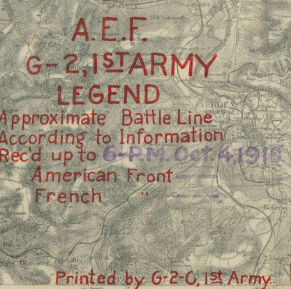
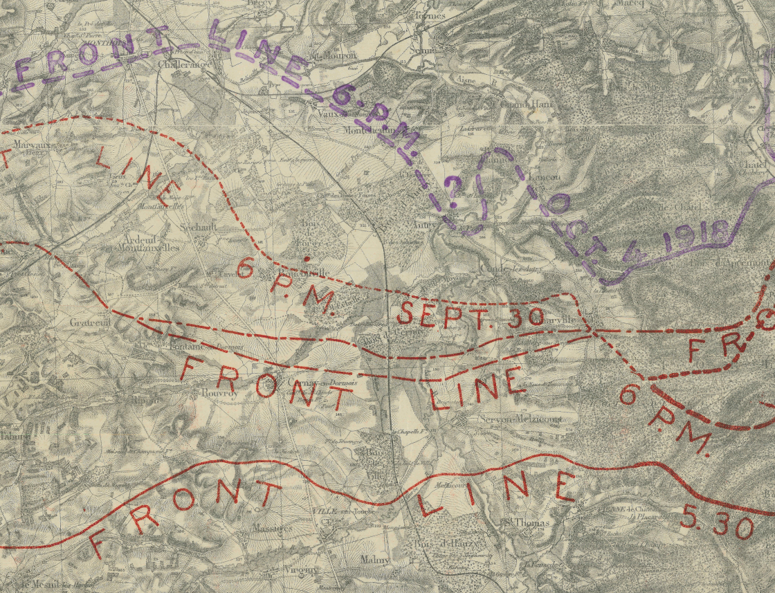
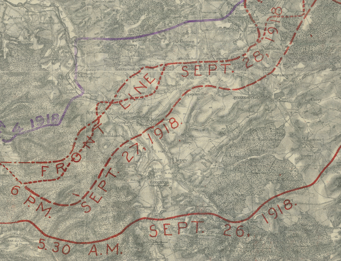
The Map's Features Produced by the G-2-C section of the AEF 1st Army and overlaid on a detailed French topographical base map of the Verdun sector, this operational document traces the progressive advance of Allied forces across five distinct dates. Red lines mark the American front at 5:30 A.M. on 26 September, and at 6:00 P.M. on 27, 28, and 30 September respectively, with information received up to 6:00 P.M. on 4 October noted in the legend. Purple markings denote the French front, illustrating the coordinated operational effort between allied commands. The underlying topography—ridgelines, river valleys, forests, and road networks—gives full context to the tactical challenges encountered with each day's advance.
Historical Significance The Meuse-Argonne Offensive delivered the decisive blow that compelled Germany to seek an armistice, directly ending the First World War. The campaign produced more American casualties than any other operation in U.S. military history, cementing the AEF's role as a decisive force on the Western Front. This field-produced intelligence map is a primary operational document from those pivotal forty-seven days—a direct record of how American and French commanders tracked the grinding, yard-by-yard advance that brought the war to its conclusion.
Museum-Quality Reproduction This is a high-quality reproduction of the original historic map, professionally printed on archival Hahnemühle paper using the Giclée printing process to preserve fine cartographic detail, line clarity, and period authenticity for long-term display.
Perfect For:
- World War I historians and researchers of the Western Front
- Veterans and families with connections to the AEF or 1st Army
- Collectors of original military intelligence cartography
- Offices, studies, and institutional libraries
- Gifts honoring American service in the First World War
Specifications:
- Original Publication: 1918
- Publisher: G-2-C, 1st Army, American Expeditionary Force
- Style: Operational front line progression map
- Battle/Conflict: Meuse-Argonne Offensive (World War I)
- Battle Result: American and Allied Victory
- Product Type: High-Quality Reproduction Print
Dimensions (Width x Height): 33.3 x 23.6
Each map is printed using the finest materials and methods. Your map will be handled with white gloves from start to finish. We use the Giclée printing method on Hahnemühle paper, which produces a clear, extremely detailed, durable map perfect for proud display in your home or office.
Choose options
