

Normandy, France – 1944 Allied D-Day Operational Assault Map
Normandy, France – 1944 Allied D-Day Operational Assault Map
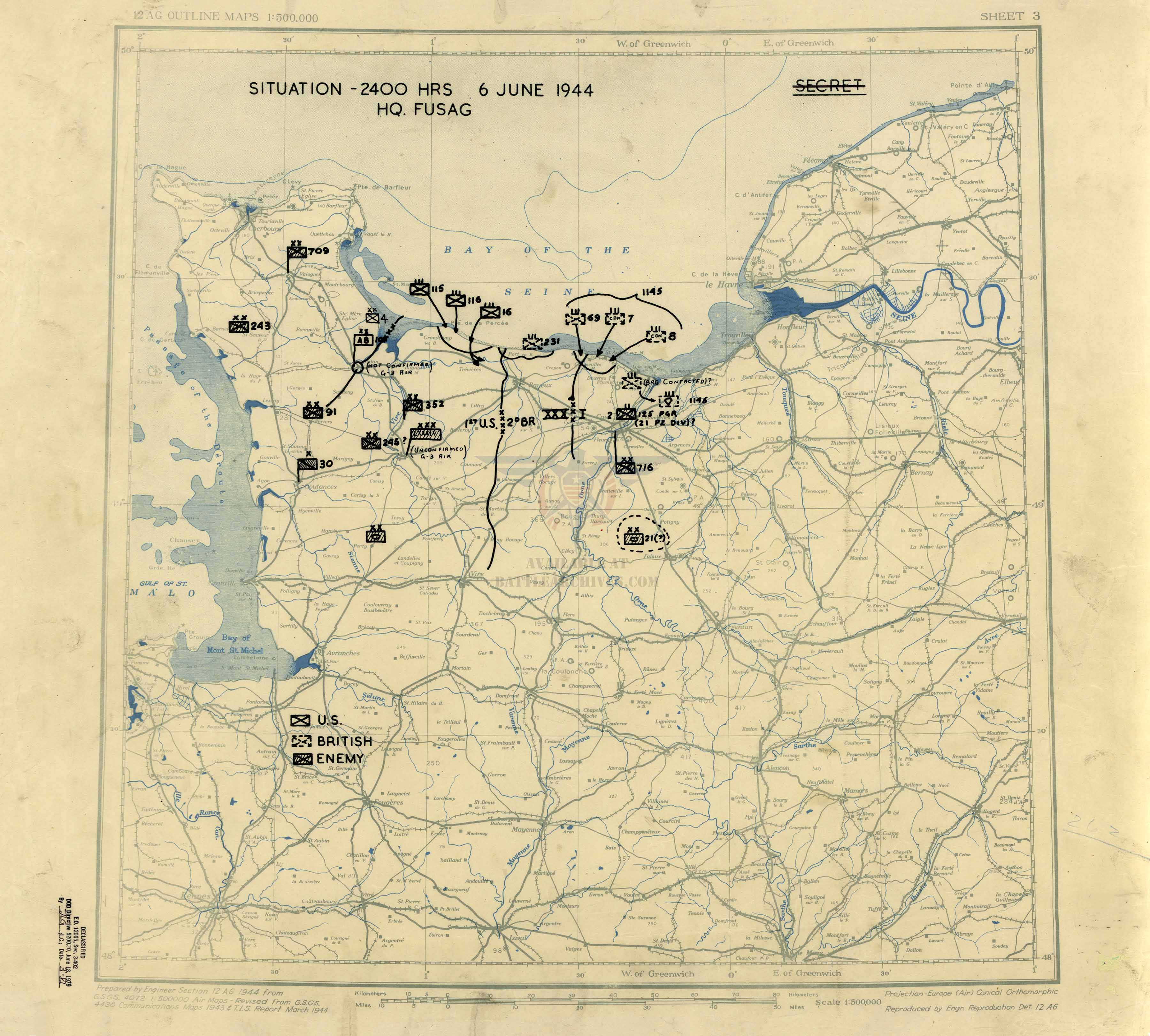
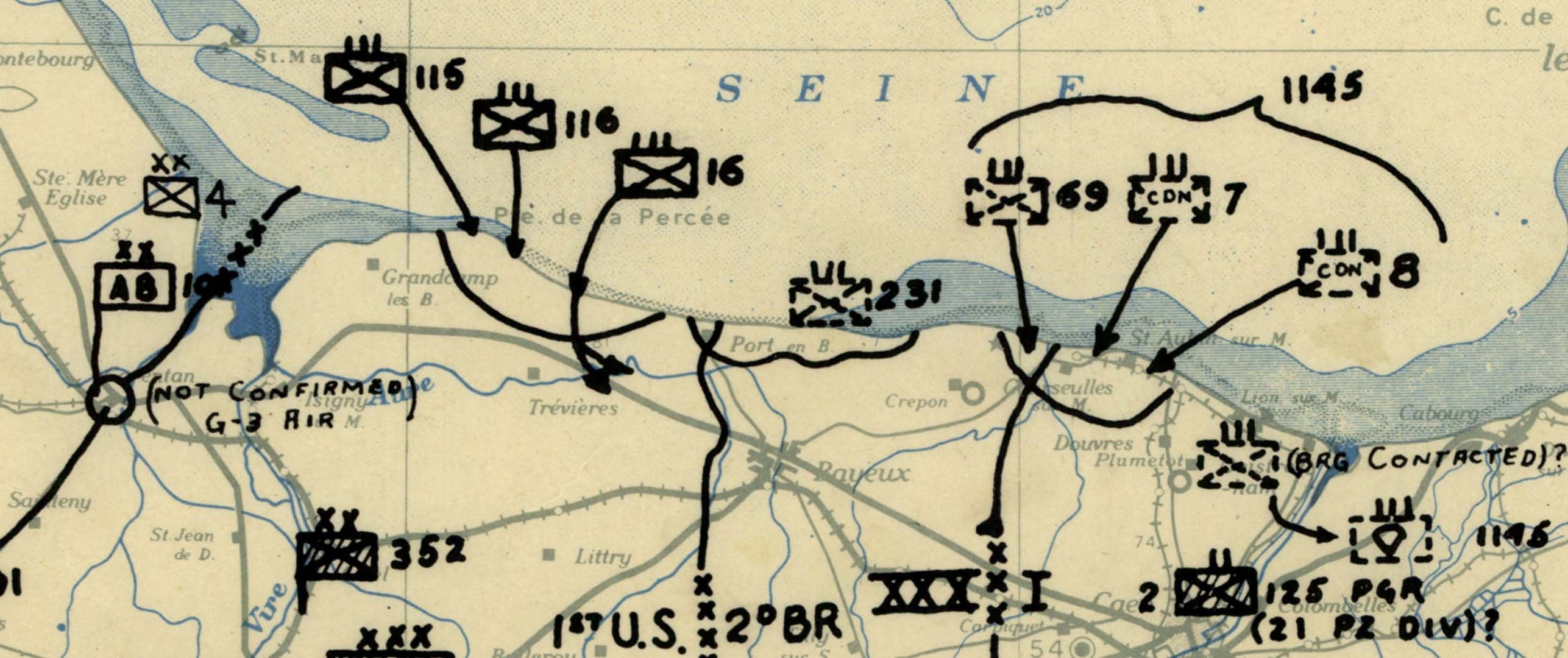
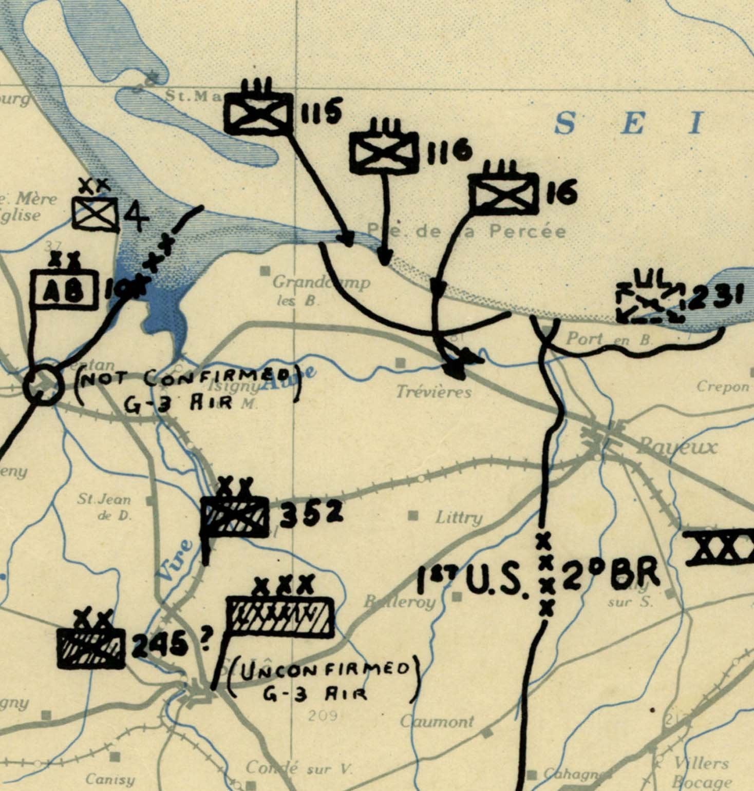
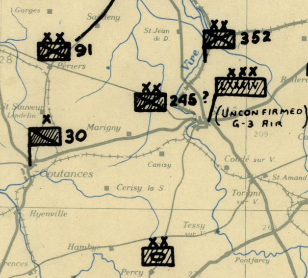
Examine the opening phase of the largest amphibious invasion in history with this detailed Allied operational assault map of Normandy. Issued at the end of June 6, 1944, this historic military document shows where Allied units had come ashore and established control during the first day of the D-Day landings.
Historical Context
On June 6, 1944, Allied forces launched Operation Overlord, the long-planned invasion of German-occupied France. American, British, and Canadian troops landed along five beaches—Utah, Omaha, Gold, Juno, and Sword—facing fortified defenses, difficult terrain, and intense resistance. By the end of the day, Allied commanders needed a clear operational picture of which objectives had been secured and where forces were positioned.
This map reflects the operational situation at the close of D-Day. Rather than depicting abstract planning concepts, it documents beachhead control, unit landings, and territorial gains achieved during the invasion’s opening hours as the campaign in Western Europe began in earnest.
The Map’s Features
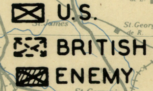
This operational assault map presents the Allied position with clarity and military precision, showing:
• Landing beaches including Utah, Omaha, Gold, Juno, and Sword
• Assault sectors and unit control areas
• Amphibious landing zones and approach corridors
• Secured beachheads and inland penetration points
• Road networks and terrain influencing movement
• Coastal defenses and key geographic features
The structured symbology and layout reflect the professional cartographic standards used by Allied operational planners during World War II.
Historical Significance
The Normandy landings marked the turning point of the war in Europe. This map preserves the moment when the invasion transitioned from perilous landings to established footholds on the continent. For historians and collectors, it offers a rare operational snapshot of Allied control at the end of D-Day—capturing the fragile but decisive progress that made the liberation of Western Europe possible.
Museum-Quality Reproduction
This is a high-quality reproduction of the original World War II military map, professionally printed using museum-grade methods and materials to preserve every detail of this historic operational document. Each piece is produced on archival Hahnemühle paper using the Giclée printing process, ensuring exceptional clarity, durability, and a refined finish suitable for display in any setting.
Perfect For
• World War II and European Theater historians
• Military professionals and veterans
• D-Day and Normandy collectors
• Offices, libraries, and study spaces
• Gifts for history enthusiasts
• Commemorative displays honoring Allied service
Specifications
• Original Publication: June 6, 1944
• Publisher: Allied Expeditionary Force – Map & Chart Division
• Style: Mid-20th-century operational assault map
• Features: Landing beaches, unit control areas, secured beachheads, terrain, road networks, coastal defenses
• Product Type: High-Quality Reproduction Print
• Scale: Not specified
• Dimensions (Width x Height): 22.2 x 20
Each map is printed using the finest materials and methods. Your map will be handled with white gloves from start to finish. We use the Giclée printing method on Hahnemühle paper, which produces a clear, extremely detailed, durable map perfect for proud display in your home or office.
Digital watermark does not appear on your purchased map.
Choose options
