


Stalingrad Front Lines - September 27, 1942 German Battle Map
Stalingrad Front Lines - September 27, 1942 German Battle Map
Witness the turning point of World War II's most brutal battle with this rare captured German Wehrmacht operational map from September 27, 1942. Originally printed by German forces in Warsaw and used during active combat operations around Stalingrad, this extraordinary map shows hand-drawn tactical positions and movements as the battle reached its critical phase—the day German forces shifted their assault to Stalingrad's northern industrial district.
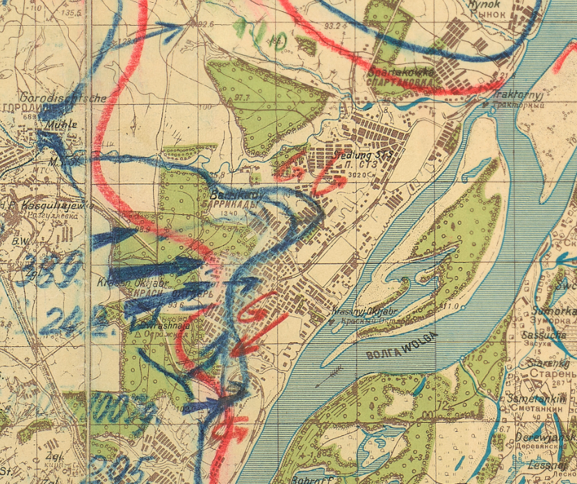
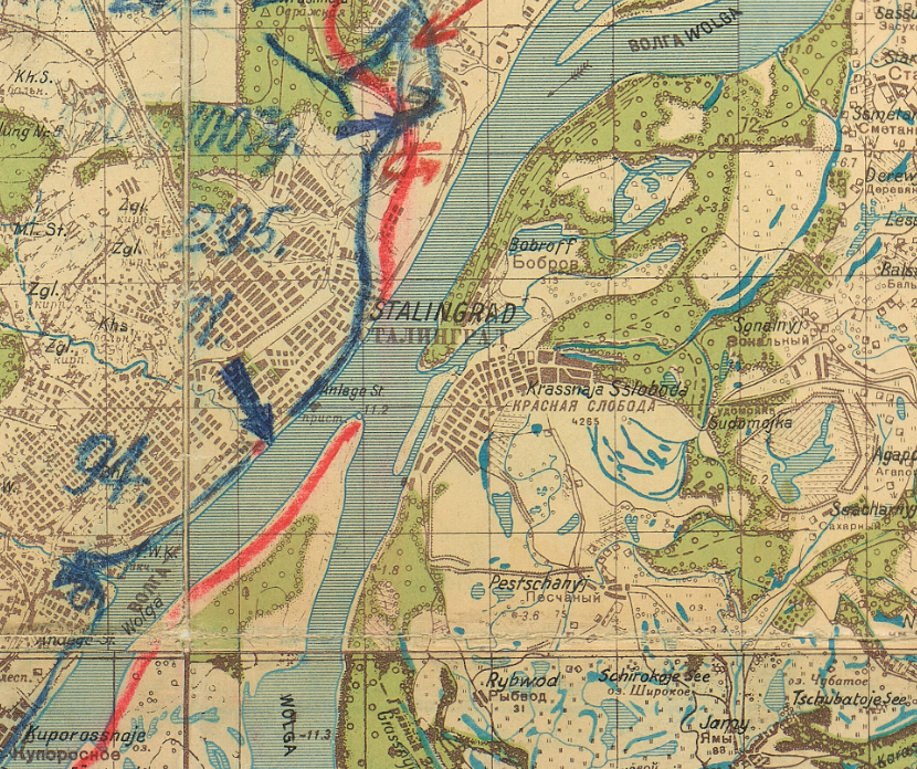
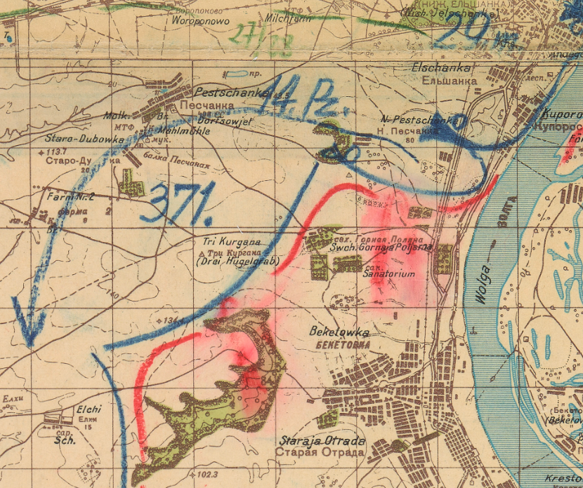
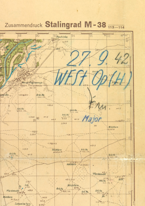
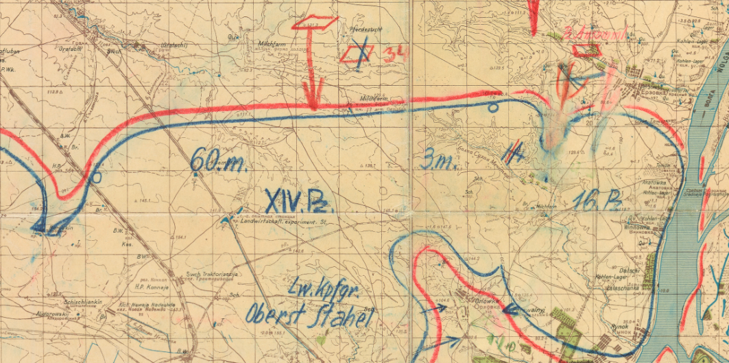
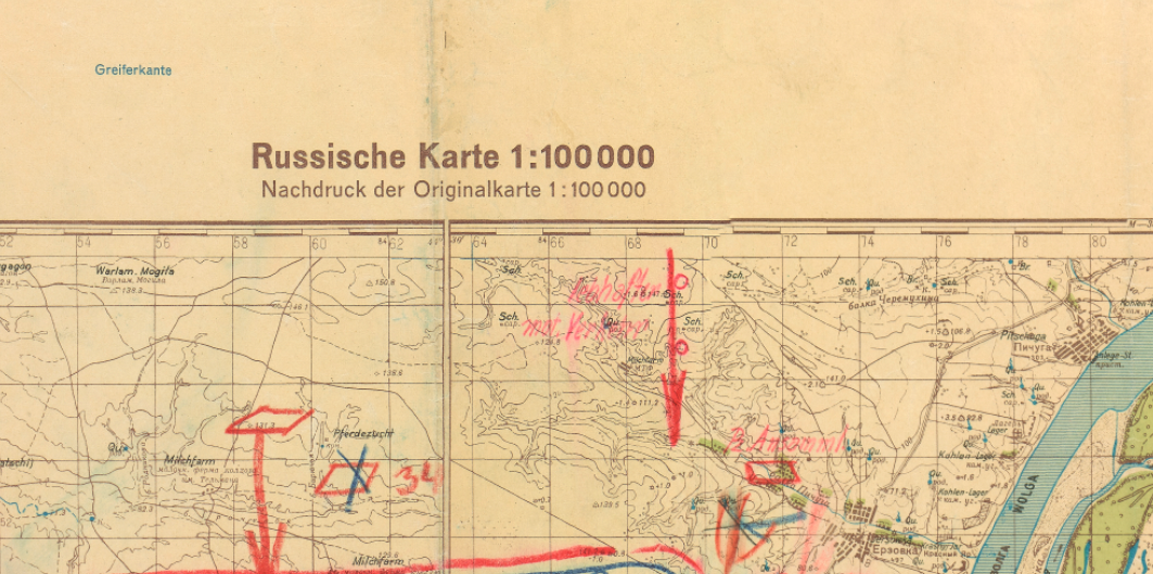
The Battle in Real Time This remarkable topographical map—labeled "Stalingrad M-38"—reveals the tactical situation as it unfolded on September 27, 1942. German forces and front lines are marked in blue grease pencil, Soviet positions in orange, showing the constantly shifting battle as Wehrmacht units advanced toward three massive factories: the Red October Steel Works, Barricades Factory, and Tractor Factory. The hand-drawn annotations document elements of the German 51st Army Corps, 6th Army, 4th Panzer Army, XIV Panzer Corps, XVI Panzer Division, Kampfgruppe Stahel, and XXXXIII Panzer Corps as they pushed northward against fierce Soviet resistance. Multiple Soviet counterattacks are visible—one repulsed and erased, others probing German lines from the north. The evolving tactical situation is evident in the repeatedly redrawn blue lines showing the German advance, while a Soviet assault from the south appears erased, either recorded in error or swept back by the German offensive.
Historical Significance September 27, 1942 marked a pivotal moment in the Battle of Stalingrad. After ten days of brutal street fighting, German forces finally stood before the industrial heart of the city—the massive factory complexes that would become the scene of some of the war's most desperate combat. This operational map provides an authentic German military perspective on the battle that would prove to be Nazi Germany's greatest defeat. Over the following months, the Wehrmacht would become trapped in Stalingrad's ruins, leading to the encirclement and destruction of the entire 6th Army in February 1943. This map captures the moment when German forces believed victory was within reach, making it a haunting primary source document from history's deadliest battle.
Framing Options This map is available unframed or professionally framed and ready to hang. Choose from a classic Black Frame or a warm Walnut Brown Frame, each matted with 4-ply white archival mat board and finished with non-glare acrylic glazing for a clean, museum-style presentation. Framed orders are professionally assembled and shipped directly to your door. Please allow 3–4 weeks for delivery on framed orders.
Museum-Quality Reproduction. This is a high-quality reproduction of an original captured German Wehrmacht operational map, professionally printed using museum-grade methods and materials to preserve every detail of this rare historical artifact, including the hand-drawn tactical annotations.
Perfect For:
- World War II historians and Eastern Front specialists
- Military collectors seeking rare primary source documents
- Students of military strategy and tactical operations
- Anyone fascinated by the Battle of Stalingrad
- Museum-quality displays and historical collections
Specifications:
- Original Date: September 27, 1942
- Created By: Wehrmacht, printed in Warsaw
- Style: Topographical map with hand-drawn tactical overlays in grease pencil
- Scale: 1:100,000
- Features: German positions (blue), Soviet positions (orange), unit designations, tactical movements
- Product Type: High-Quality Reproduction Print
Dimensions (Width x Height): 24 x 27
Each map is printed using the finest materials and methods. Your map will be handled with white gloves from start to finish. We use the Giclee printing method on Hahnemuhle paper, which produces a clear, extremely detailed, durable map that is perfect to be proudly displayed in your home or office.
Choose options
