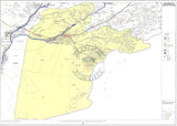
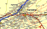
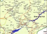
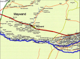
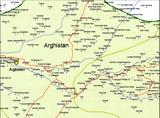
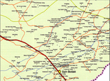


Kandahar Province, Afghanistan 2003 Provincial Map
Kandahar Province is located in southeast Afghanistan with parts of it's eastern and southern border touching Pakistan. The city of Kandahar is the second largest city in Afghanistan and is located within the province. The foundation for the city was mapped out by Alexander the Great as he pushed towards India on his conquests. The Taliban made Kandahar the capital of Afghanistan until the US led invasion of 2001.
Created/Published: 2003
Dimensions (Width x Height): 32.9x24
Each map is printed using the finest materials and methods. Your map will be handled with white gloves from start to finish. We use the Giclee printing method on Hahnemuhle paper, which produces a clear, extremely detailed, durable map that is perfect to be proudly displayed in your home or office.
Digital watermark does not appear on your purchased map.


