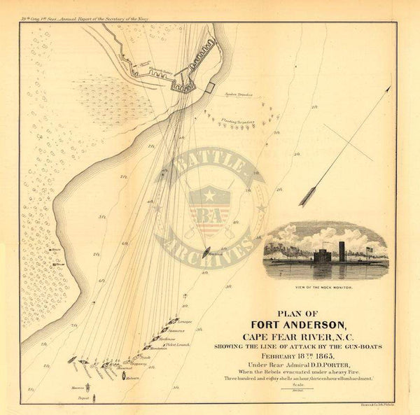
Fort Fisher, North Carolina Line of Battle Map
$79
High level map showing the naval portion of the combined sea and land attack on Fort Fisher, North Carolina in 1865. Each ship in the attack led by Rear Admiral Porter is shown along with the depth of the water in the Atlantic as well as the Cape Fear River.
Result: Union Victory
Created/Published: 1865
Dimensions (Width x Height): 29.2x19.4
Each map is printed using the finest materials and methods. Your map will be handled with white gloves from start to finish. We use the Giclee printing method on Hahnemuhle paper, which produces a clear, extremely detailed, durable map that is perfect to be proudly displayed in your home or office.
Digital watermark does not appear on your purchased map.