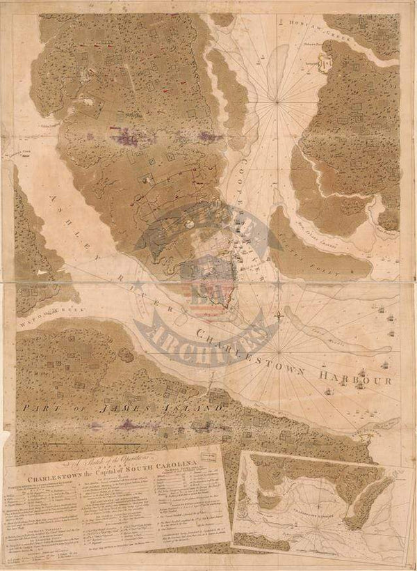
West Point, New York Hand Drawn 1783 Map with Great Chain Map
West Point is famous for during the Revolutionary War the Continental Army constructed "The Great Chain" across the Hudson River to prevent British ships from sailing up the Hudson and into the interior of New York. This is also where the United States Military Academy was established in 1802.
Hand drawn map showing West Point, The Great Chain, and the surrounding areas. This map includes vast amounts of hand written notes, references, and drawings of fortifications.
Created/Published: 1783
Scale: 21,000
Dimensions (Width x Height): 19.2x23.3
Our printing is archive-quality.
Each map is printed using the finest materials and methods. Your map will be handled with white gloves from start to finish. We use the Giclee printing method on the finest paper, which produces a clear, extremely detailed, durable map that is perfect to be proudly displayed in your home or office.
About our framing:
- Non-glare acrylic to reduce reflection
- Dry mount to ensure your map is smooth and without wrinkles
- 1.5 inch, 4-ply white mat to accentuate your map
- Black, light walnut, and natural frame color options to match any room
- Wire mounting
- Please note that we cannot refund or return custom framed maps. We can replace a damaged frame. If your frame is damaged, please use the Contact Us or email customercare@battlearchives.com
Digital watermark does not appear on your purchased map