Anzio Beachhead and Italy Campaign Map – World War II
Anzio Beachhead and Italy Campaign Map – World War II
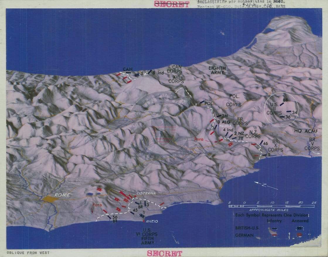
Experience a pivotal chapter of the Italian Campaign through this detailed operational map depicting the Allied amphibious landing at Anzio and subsequent fighting south of Rome. Centered on the Anzio beachhead, the map illustrates unit positions, corps movements, and the rugged terrain that shaped months of hard-fought combat in early 1944.
Historical Context
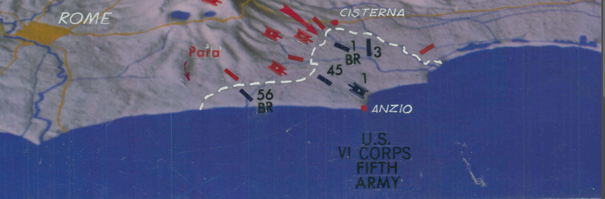
Operation Shingle began on January 22, 1944, when Allied forces landed at Anzio, approximately 50 kilometers (31 miles) south of Rome. Intended to outflank German defensive lines and accelerate the capture of the Italian capital, the landing instead led to a prolonged and costly stalemate. After months of fierce resistance, the Allies finally broke out of the beachhead and entered Rome on June 4, 1944—just two days before the D-Day landings in Normandy shifted global attention to France.
The Map’s Features
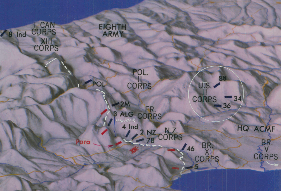
Presented in oblique perspective from the west, the map shows central Italy’s mountainous terrain, coastline, and strategic road networks. The Anzio beachhead is clearly marked near the center bottom, with symbols identifying British, U.S., and German formations, including corps and division-level positions. Unit markers and directional arrows provide a visual summary of operational movements during the campaign.
Historical Significance
This map serves as a visual record of one of the most complex amphibious operations of the European Theater. It captures the geographic challenges, multinational Allied coordination, and the prolonged struggle required to break through entrenched German defenses in Italy.
Museum-Quality Reproduction
This is a high-quality reproduction of the original World War II campaign map, professionally printed on archival Hahnemühle paper using the Giclée printing process to preserve terrain shading, unit markings, and fine cartographic detail for long-term display.
Perfect For:
• Collectors of World War II campaign maps
• Students of the Italian Campaign
• Military history enthusiasts
• Veterans and families connected to the Allied forces in Italy
• Offices, libraries, and study spaces
Specifications:
• Created / Published: Unknown (declassified 1986)
• Campaign: Italian Campaign – Anzio Beachhead (1944)
• Style: World War II operational battle map
• Product Type: High-Quality Reproduction Print
Dimensions (Width x Height): 11 x 8.7
Each map is printed using the finest materials and methods. Your map will be handled with white gloves from start to finish. We use the Giclée printing method on Hahnemühle paper, which produces a clear, extremely detailed, durable map perfect for proud display in your home or office.
Choose options
