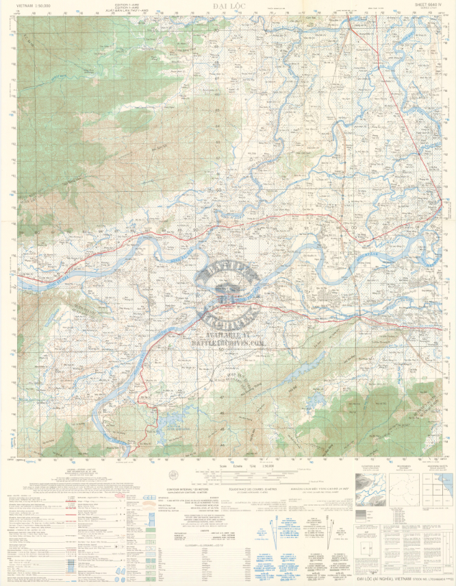

Arizona Territory & “Dodge City,” Vietnam – 1965 Topographical Map
Arizona Territory & “Dodge City,” Vietnam – 1965 Topographical Map
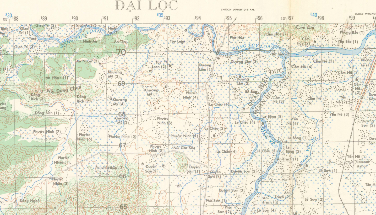
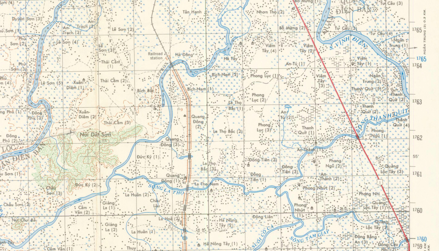
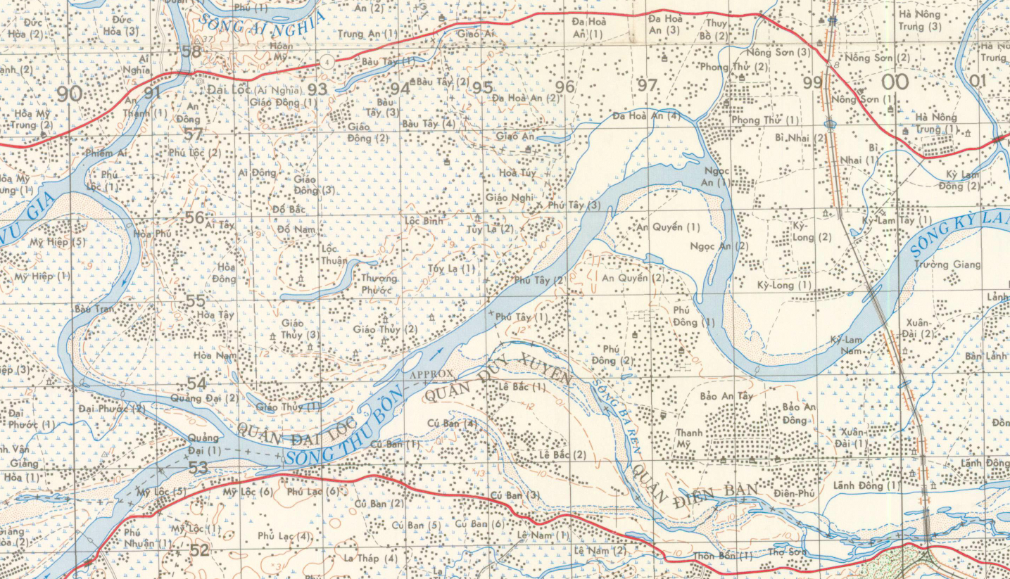
Few places in Vietnam carried a name as infamous as the “Arizona Territory.” Located south and west of Da Nang, this area earned its nickname from American troops who compared the intensity of combat to the lawless frontier of the Old West. Designated at times as a free-fire zone, it became one of the most contested regions in I Corps. This detailed 1965 topographical map places you directly inside that landscape—showing the rivers, villages, elevation lines, and terrain features that defined operations in and around Arizona Territory and the area known as “Dodge City.”
Historical Context In 1965, as U.S. combat operations expanded, the region southwest of Da Nang saw sustained engagements between American, ARVN, and Viet Cong forces. The geography—river valleys, rice paddies, hedgerows, and elevated ground—shaped patrol routes, ambush sites, and large-scale search-and-destroy missions. Understanding the terrain was not optional; it was survival.
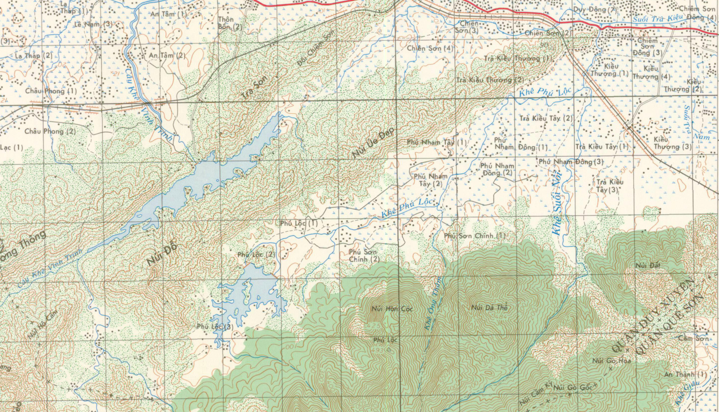
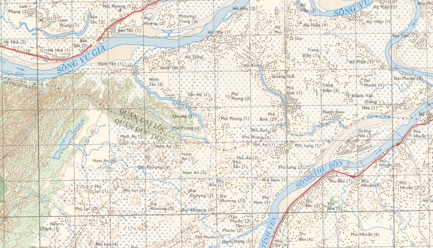
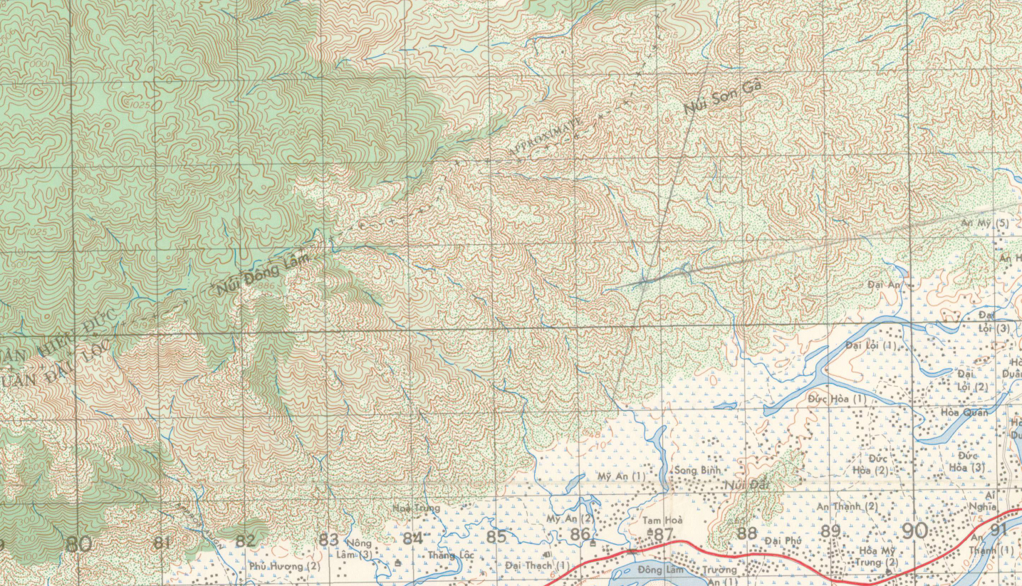
The Map’s Features Produced at a precise 1:50,000 scale, this military topographical map shows contour lines, waterways, village names, road networks, grid references, and operational boundaries. The clarity and detail allow you to trace the ground exactly as commanders and troops would have studied it—down to stream crossings, elevation shifts, and key approach routes.
Historical Significance Topographical maps like this were working tools of war. They were carried in the field, marked, folded, and studied before operations. Today, they serve as powerful historical artifacts—connecting veterans, families, and students of history to the exact terrain where events unfolded. For collectors, this is not just a map—it is a direct link to one of the most intense regions of the Vietnam War.
Museum-Quality Reproduction This is a high-quality reproduction of the original 1965 military topographical map, professionally printed on archival Hahnemühle paper using the Giclée printing process to preserve fine contour detail, cartographic precision, and period authenticity for long-term display.
Perfect For:
• Vietnam War veterans and their families
• Military historians and serious map collectors
• Those who served in I Corps or around Da Nang
• Offices, studies, and veteran memorial displays
• Meaningful gifts honoring service and sacrifice
Specifications:
• Original Publication: 1965
• Scale: 1:50,000
• Style: Military topographical operational map
• Battle/Conflict: Vietnam War
• Product Type: High-Quality Reproduction Print
Dimensions (Width x Height): 22.6 x 29.2
Each map is printed using the finest materials and methods. Your map will be handled with white gloves from start to finish. We use the Giclée printing method on Hahnemühle paper, which produces a clear, extremely detailed, durable map perfect for proud display in your home or office.
Digital watermark does not appear on your purchased map.
Choose options
