


Chancellorsville, Virginia – May 1863 Three-Day Campaign Battle Map
Chancellorsville, Virginia – May 1863 Three-Day Campaign Battle Map
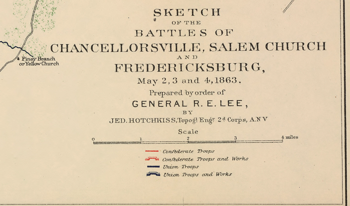
This large-scale Confederate battlefield sketch documents the full sweep of the Chancellorsville Campaign across its three decisive days — May 2, 3, and 4, 1863 — capturing not only the Battle of Chancellorsville itself but the concurrent engagements at Salem Church and Fredericksburg that together comprised one of the most operationally complex Confederate victories of the Civil War. Prepared under the direction of General Robert E. Lee and published between 1891 and 1893, this map represents the Confederate army's own authoritative cartographic record of the campaign — rendered with the benefit of postwar reflection and the full arc of the three-day engagement in view.
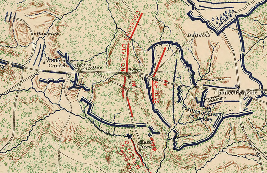
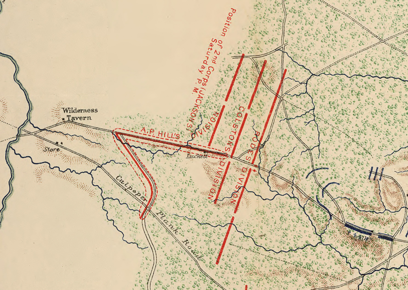
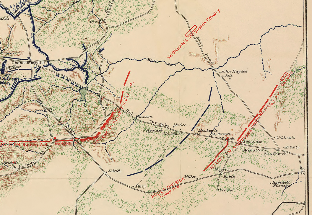
Historical Context The Chancellorsville Campaign was never a single battle. While Jackson's flank attack on May 2 dominates popular memory, the Confederate victory required simultaneous management of multiple threats across a wide front. On May 3, Lee reunited his divided army and pressed the disorganized Army of the Potomac back toward the Rappahannock River — the most intense day of fighting in the entire campaign. That same day, Union Major General John Sedgwick's VI Corps broke through Confederate lines at Fredericksburg and advanced westward along the Plank Road toward Lee's rear, threatening to trap the Confederate army between two Union forces. Lee again divided his command, dispatching forces eastward to check Sedgwick at Salem Church on May 3 and driving him back across the river on May 4. This map captures all three engagements simultaneously — a rare operational panorama of the full campaign that no single-day map can provide.
The Map's Features Drawn at large scale and color-coded to distinguish Confederate and Union positions and lines of advance, this sketch map presents the complete operational theater from Fredericksburg in the east to the Wilderness crossroads in the west. Blue markings indicate Union troop positions and movements; red Confederate. The Rapidan and Rappahannock Rivers frame the northern boundary of the theater, with key crossing points — Banks' Ford, United States Ford, and Fredericksburg — all documented. The road network connecting Chancellorsville, Salem Church, and Fredericksburg is rendered in detail, illustrating the interior lines Lee exploited to shift forces between threats across three consecutive days. Woodland cover is rendered in green wash, conveying the dense Wilderness terrain that shaped every tactical decision of the campaign. The legend confirms the map's Confederate provenance and tri-battle scope.
Historical Significance No map in the Chancellorsville cartographic record presents the campaign's full operational logic as completely as this one. The simultaneous documentation of Chancellorsville, Salem Church, and Fredericksburg reveals what is often obscured in battle histories focused solely on Jackson's flank march — that Lee was managing a three-front problem with an army half the size of his opponent, and solving it. Prepared under Lee's own direction in the postwar years, this map carries the weight of institutional Confederate memory: a commander's effort to ensure the full scope of his army's achievement was preserved for history.
Framing Options This map is available unframed or professionally framed and ready to hang. Choose from a classic Black Frame or a warm Walnut Brown Frame, each matted with 4-ply white archival mat board and finished with non-glare acrylic glazing for a clean, museum-style presentation. Framed orders are professionally assembled and shipped directly to your door. Please allow 3–4 weeks for delivery on framed orders.
Museum-Quality Reproduction This is a high-quality reproduction of the original Confederate campaign map, professionally printed on archival Hahnemühle paper using the Giclée printing process to preserve the full color rendering, cartographic detail, and period authenticity of this exceptional operational document for long-term display.
Perfect For:
- Civil War historians and serious collectors
- Students of operational strategy and multi-front campaign planning
- Descendants of Confederate and Union veterans of the Chancellorsville Campaign
- Offices, studies, libraries, and heritage displays
- Gifts honoring American Civil War history
Specifications:
- Original Publication: 1891–1893
- Style: Large-scale color Confederate operational campaign map
- Battle/Conflict: Battles of Chancellorsville, Salem Church, and Fredericksburg (American Civil War)
- Battle Result: Confederate Victory
- Product Type: High-Quality Reproduction Print
Dimensions (Width x Height): 24 x 27.1
Each map is printed using the finest materials and methods. Your map will be handled with white gloves from start to finish. We use the Giclée printing method on Hahnemühle paper, which produces a clear, extremely detailed, durable map perfect for proud display in your home or office.
Choose options
