

European Theater of Operations – 1939–1945 World War II Strategic Map
European Theater of Operations – 1939–1945 World War II Strategic Map
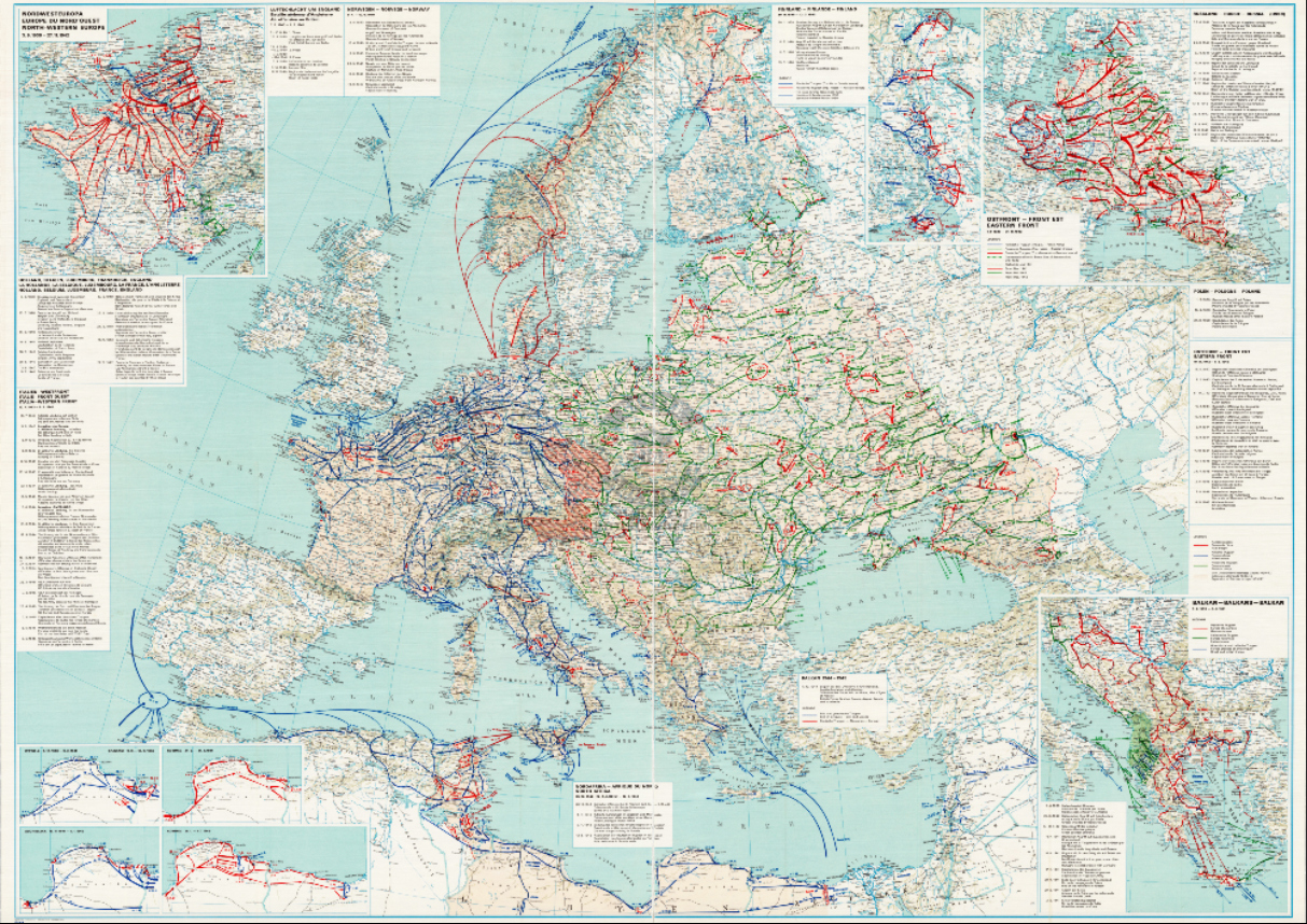
Gain a comprehensive view of World War II in Europe with this large-scale map of the European Theater of Operations, covering the conflict from 1939 through 1945. This strategic military document illustrates the full geographic scope of the war, showing how Allied and Axis operations unfolded across the continent and surrounding regions over six years of global conflict.
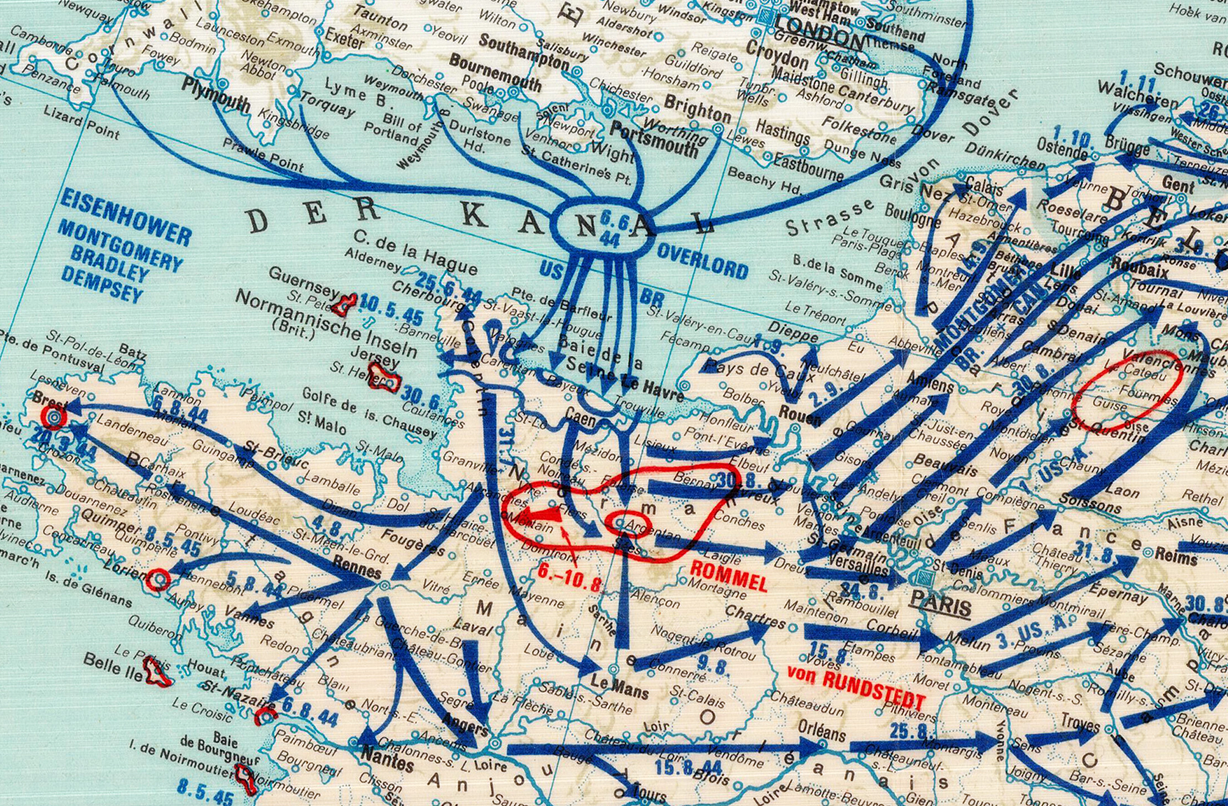
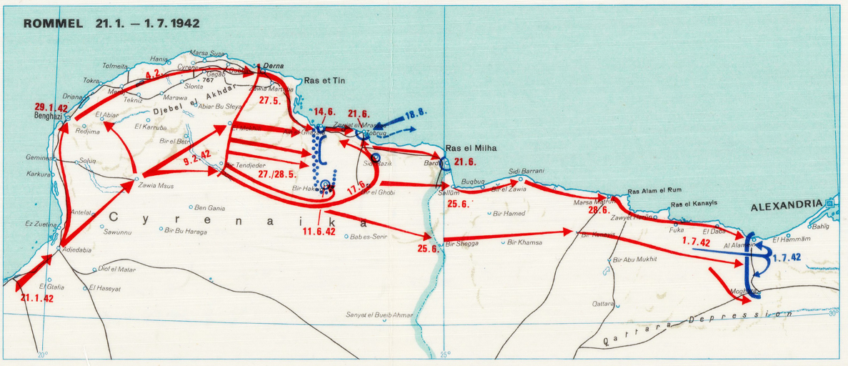
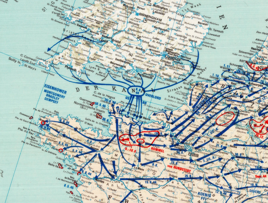
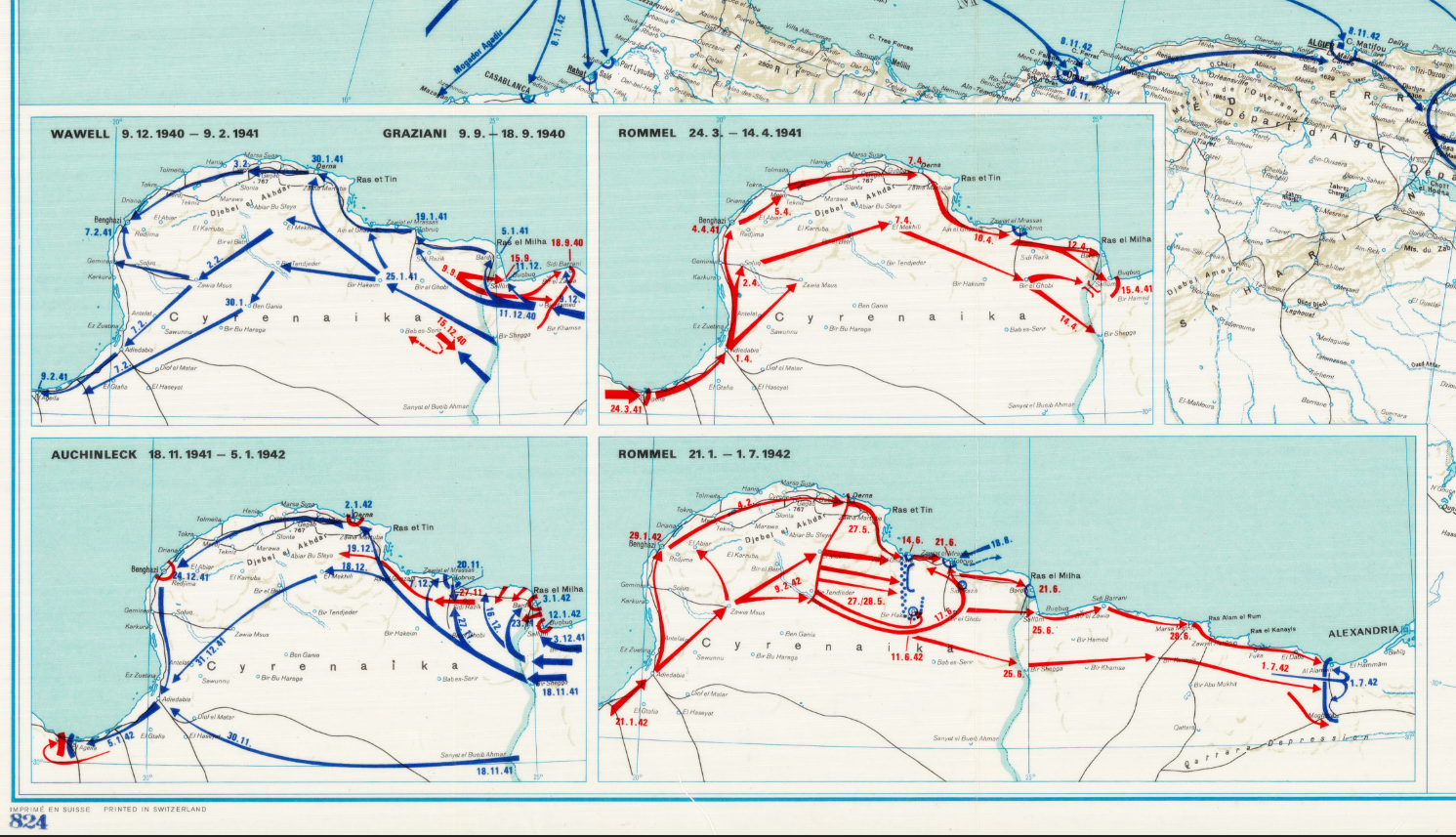
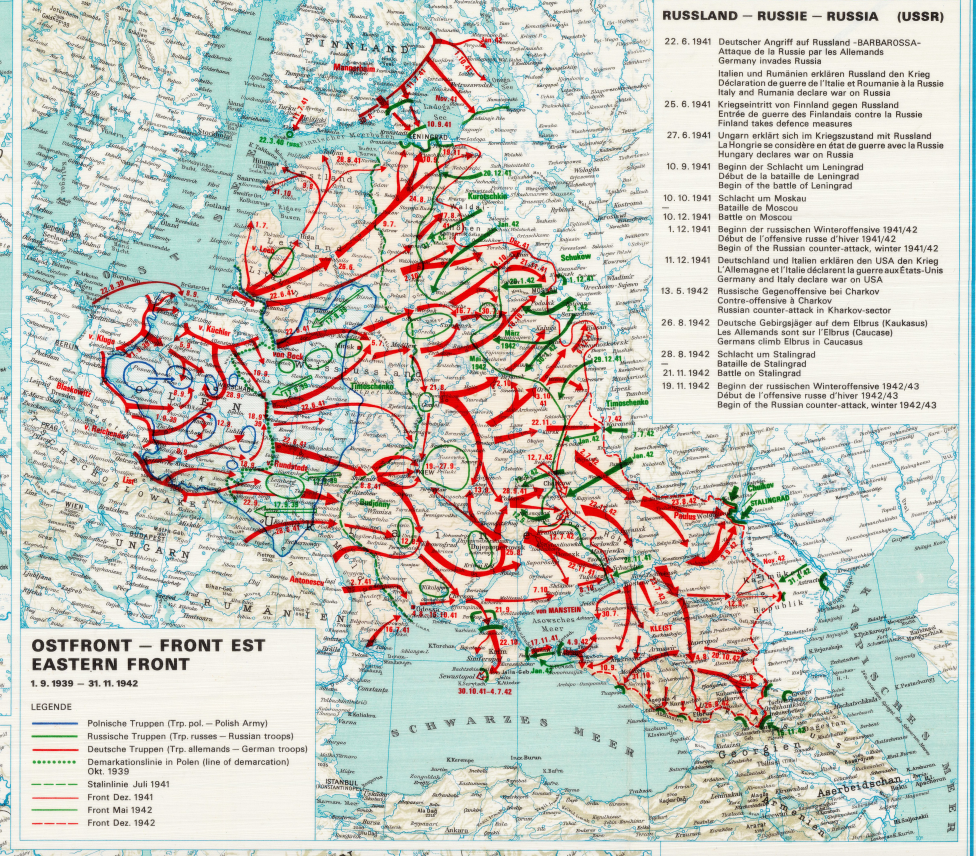
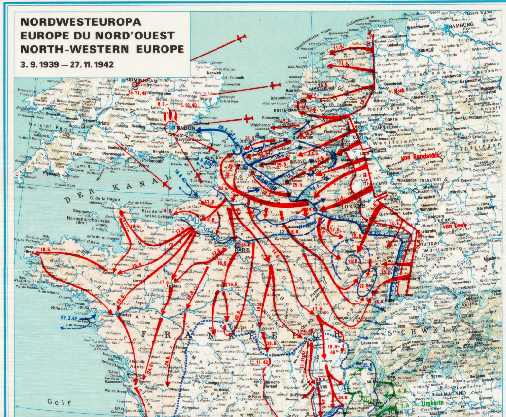
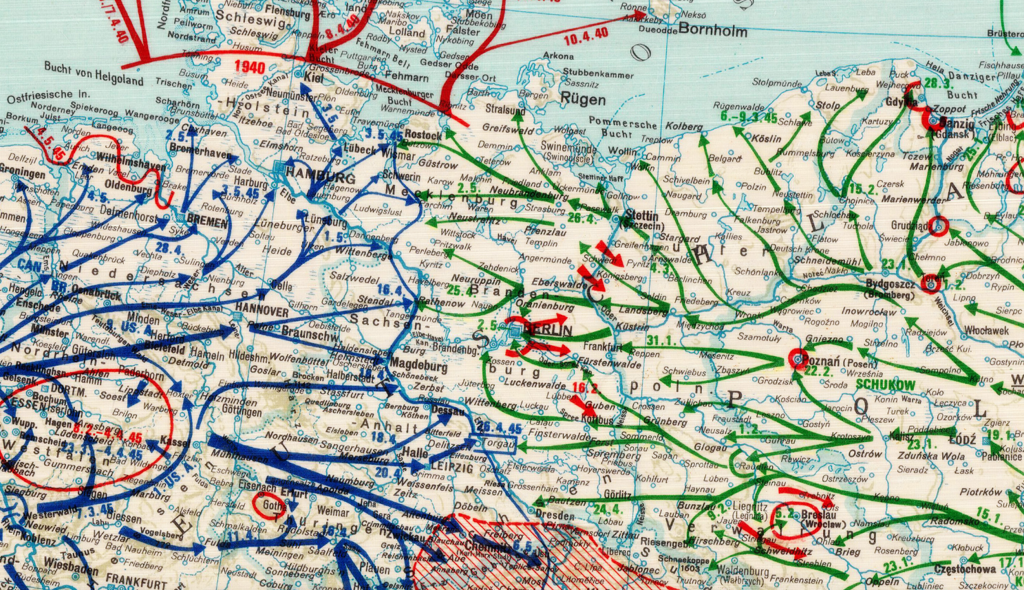
Historical Context The European Theater of Operations encompassed the primary land, air, and naval campaigns fought between Allied and Axis forces from the outbreak of war in 1939 to Germany’s surrender in May 1945. From the early Axis advances across Western Europe to the turning points at Stalingrad, North Africa, and Normandy, the theater evolved into a vast, interconnected battlefield stretching from the Atlantic Ocean to the eastern front.
Maps like this were essential for commanders, planners, and analysts seeking to understand the relationship between multiple fronts, supply routes, and strategic objectives. Rather than focusing on a single battle, this map presents the broader operational picture that defined the Allied path to victory in Europe.
The Map’s Features This strategic theater map presents World War II Europe with clarity and scale, showing:
• National boundaries and occupied territories
• Major fronts and theaters of operation
• Key cities, regions, and geographic landmarks
• Coastlines, seas, and maritime approaches
• Transportation corridors and lines of advance
• The spatial relationship between Western, Eastern, and Southern fronts
The map’s wide scope emphasizes how campaigns across different regions were interconnected parts of a single continental war.
Historical Significance Understanding World War II in Europe requires seeing the war as a whole, not just through individual battles. This map preserves that perspective, illustrating how Allied strategy unfolded across multiple fronts simultaneously. For historians and collectors, it serves as a foundational reference for understanding the scale, complexity, and coordination required to defeat the Axis powers in Europe.
Framing Options This map is available unframed or professionally framed and ready to hang. Choose from a classic Black Frame or a warm Walnut Brown Frame, each matted with 4-ply white archival mat board and finished with non-glare acrylic glazing for a clean, museum-style presentation. Framed orders are professionally assembled and shipped directly to your door. Please allow 3–4 weeks for delivery on framed orders.
Museum-Quality Reproduction This is a high-quality reproduction of the original World War II military map, professionally printed using museum-grade methods and materials to preserve every detail of this historic strategic document. Each piece is produced on archival Hahnemühle paper using the Giclée printing process, ensuring exceptional clarity, durability, and a refined finish suitable for display in any setting.
Perfect For
• World War II and European history enthusiasts
• Military professionals and educators
• Strategic studies and war planning collections
• Offices, libraries, and study spaces
• Gifts for history and geography enthusiasts
• Displays focused on global conflict and strategy
Specifications
• Original Publication: 1939–1945
• Publisher: Allied military cartographic authorities
• Style: Mid-20th-century strategic theater map
• Features: Continental overview, national boundaries, major fronts, cities, seas, and operational regions
• Product Type: High-Quality Reproduction Print
• Dimensions (Width x Height): 28 x 20
Each map is printed using the finest materials and methods. Your map will be handled with white gloves from start to finish. We use the Giclée printing method on Hahnemühle paper, which produces a clear, extremely detailed, durable map perfect for proud display in your home or office.
Digital watermark does not appear on your purchased map.
Choose options
