

European Theater of Operations Map from 1944-1945
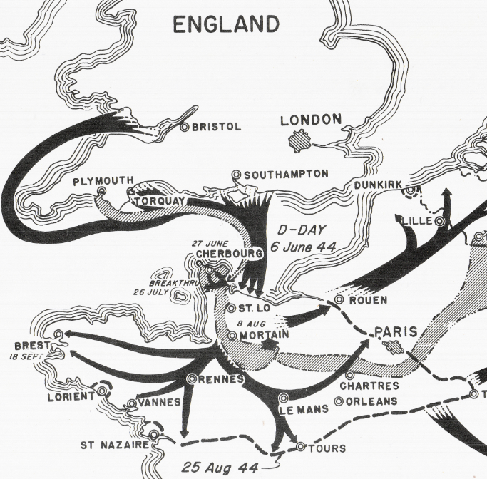
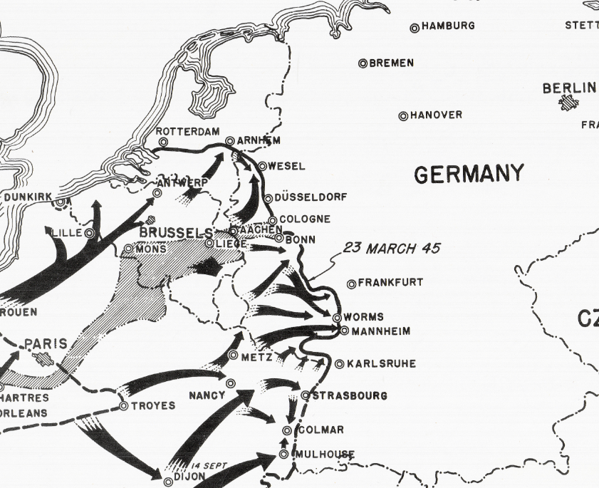
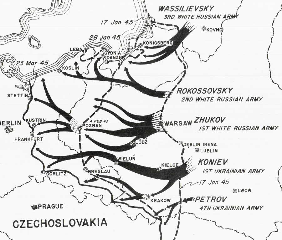
This map shows the progress of the land war in Europe on the Western, Eastern, and Italian fronts. The front lines established on this map is from 23 March 1945. In the west, there is progression from D-Day and the breakout from Normandy to entering Germany and approaching Frankfurt (am Main). On the Italian front you can see progression from troops moving north from southern Italy being joined by units coming from the Anzio beachhead and advancing towards northern Italy. On the Eastern Front, progress is shown of the Soviets as they advance across Poland to the doorstep of Germany and Berlin.
Created/Published: 1945
Dimensions (Width x Height): 28.2x20.2
Each map is printed using the finest materials and methods. Your map will be handled with white gloves from start to finish. We use the Giclee printing method on Hahnemuhle paper, which produces a clear, extremely detailed, durable map that is perfect to be proudly displayed in your home or office.
Digital watermark does not appear on your purchased map.
Choose options
