

Iwo Jima and Bonin Islands, Japan – 1945 Regional Operations Battle Map
Iwo Jima & Bonin Islands, Japan – 1945 Regional Operations Battle Map
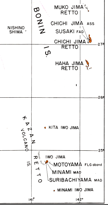
Examine the broader geographic setting of the Battle of Iwo Jima with this detailed 1945 regional operations map of the Bonin (Volcano) Islands. While the battle itself focused on the small island of Iwo Jima, this map places the engagement within the wider island chain approximately 750 miles south of Tokyo, illustrating why the island held such strategic importance within the Pacific theater.
Historical Context
The Battle of Iwo Jima was fought from February to March 1945 as part of the American advance toward the Japanese home islands. The island’s position within the Bonin chain made it a critical outpost for Japanese early-warning radar and fighter interception against U.S. B-29 bombing missions. Unlike many Pacific battles, Iwo Jima was fought entirely by U.S. Marine Corps ground forces with extensive U.S. Navy support, resulting in some of the heaviest American casualties of the war. The battle would become permanently etched into history through Joe Rosenthal’s photograph Raising the Flag on Iwo Jima, symbolizing both victory and sacrifice.
The Map’s Features
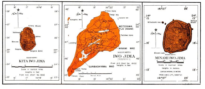
This regional military map expands beyond Iwo Jima itself to show the surrounding Bonin Islands, including Chichi Jima and other strategically significant landmasses. It illustrates island geography, relative distances, coastal outlines, and navigational references used by U.S. forces operating throughout the chain. By situating Iwo Jima within its wider operational environment, the map highlights the isolation of the battlefield and the logistical challenges faced by American planners.
Historical Significance
While Iwo Jima is remembered for its brutal ground combat, this map underscores that the battle was part of a much larger strategic picture. Control of the Bonin Islands secured vital air and sea lanes, reduced Japanese defensive depth, and brought American forces within direct reach of the Japanese mainland. As a companion piece to assault and landing maps, this document helps explain why Iwo Jima mattered—and why its capture came at such extraordinary cost.
Museum-Quality Reproduction
This is a high-quality reproduction of the original 1945 military map, professionally printed using museum-grade methods and materials to preserve every cartographic detail of this historic operational document.
Perfect For
• World War II and Pacific Theater historians
• U.S. Marine Corps veterans and families
• Military map and cartography collectors
• Offices, libraries, and study spaces
• Displays complementing Iwo Jima assault maps
• Commemorative collections honoring WWII service
Specifications
• Battle Result: American Victory
• Created / Published: 1945
• Style: Mid-20th-century regional military operations map
• Product Type: High-Quality Reproduction Print
• Dimensions (Width x Height): 18.9 x 26.9
Each map is printed using the finest materials and methods. Your map will be handled with white gloves from start to finish. We use the Giclée printing method on Hahnemühle paper, which produces a clear, extremely detailed, durable map perfect for proud display in your home or office. Digital watermark does not appear on your purchased map.
Choose options
