

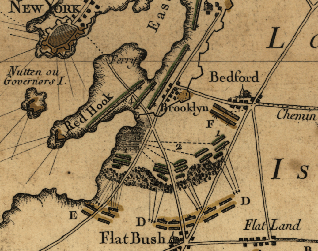
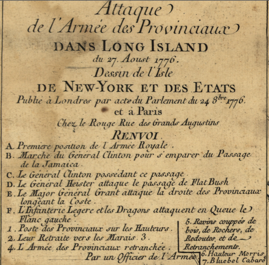
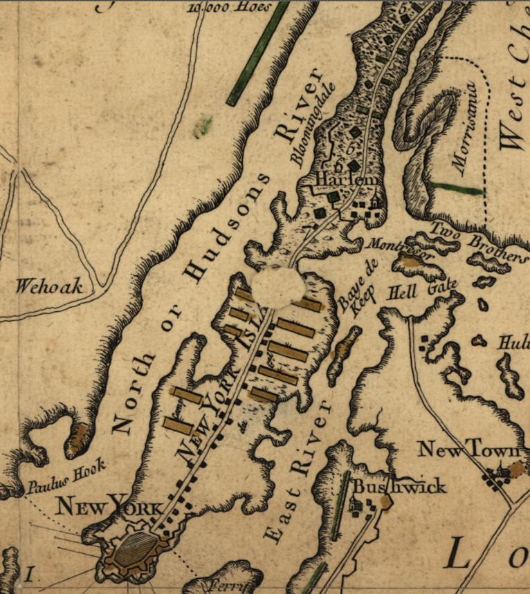
Long Island (or Brooklyn or Brooklyn Heights), New York French Battle Map
The Battle of Long Island (or Brooklyn or Brooklyn Heights) was fought on 27 August 1776, less than two months after the Declaration of Independence. The British drove Washington and the Continental Army back to Manhattan. Washington's escape back to Manhattan prevented a potential disaster that could have ended with the Revolution quelled soon after it started.
French map showing the battle along with large portions of Long Island, Staten Island, New Jersey, and north along the Hudson River.
Result: British Victory
Created/Published: 1776
Scale: 100,000
Dimensions (Width x Height): 13.1x14.3
Each map is printed using the finest materials and methods. Your map will be handled with white gloves from start to finish. We use the Giclee printing method on Hahnemuhle paper, which produces a clear, extremely detailed, durable map that is perfect to be proudly displayed in your home or office.
Digital watermark does not appear on your purchased map.
Choose options
