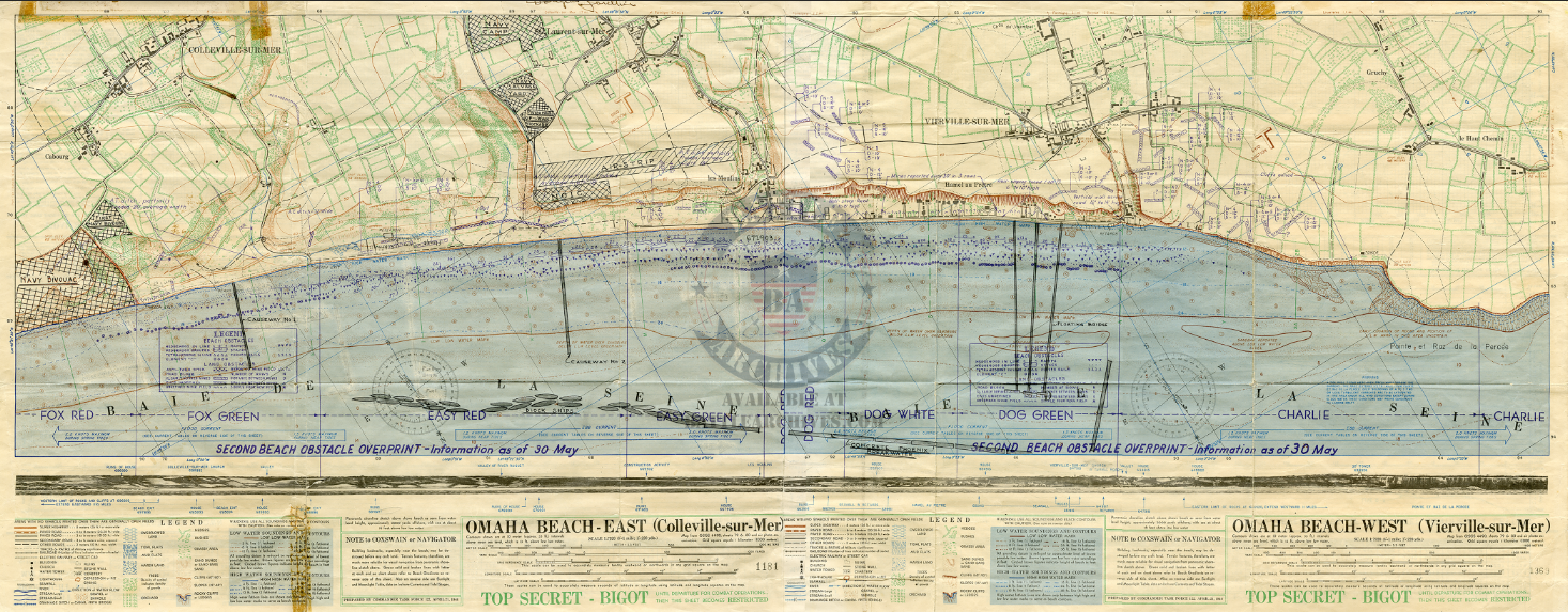
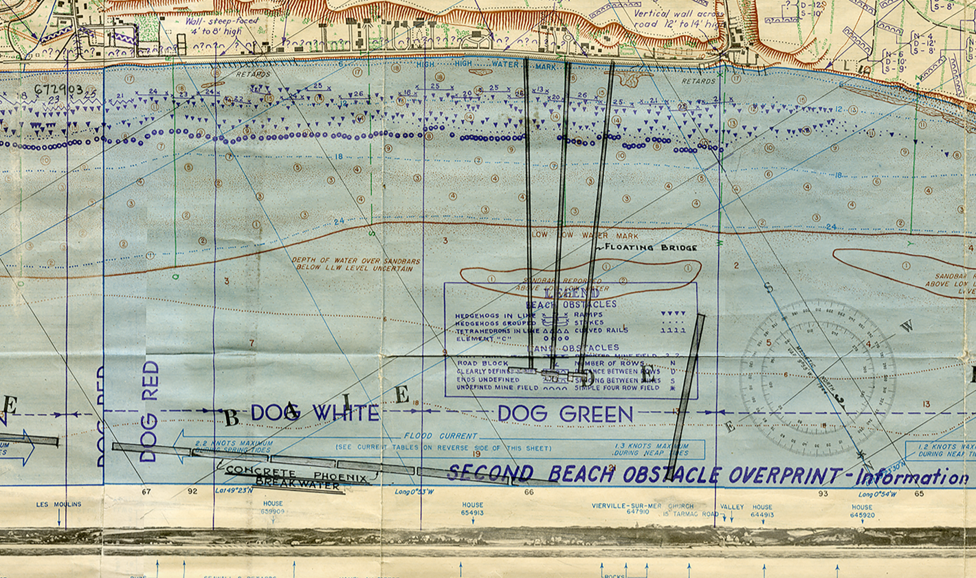
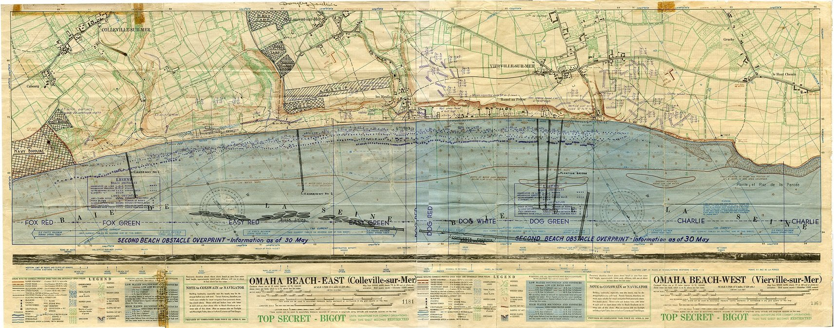
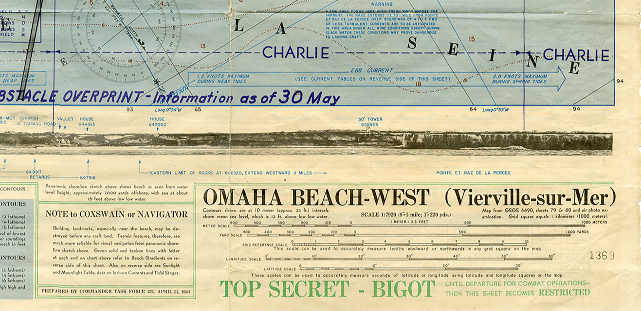
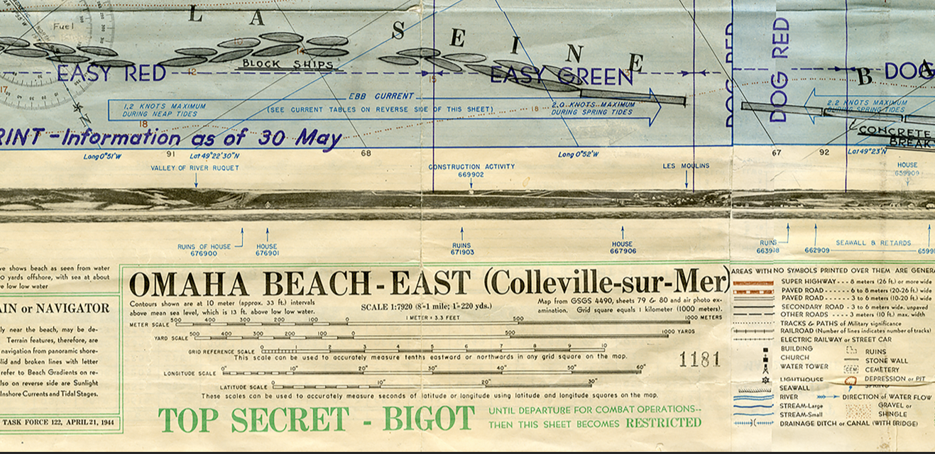
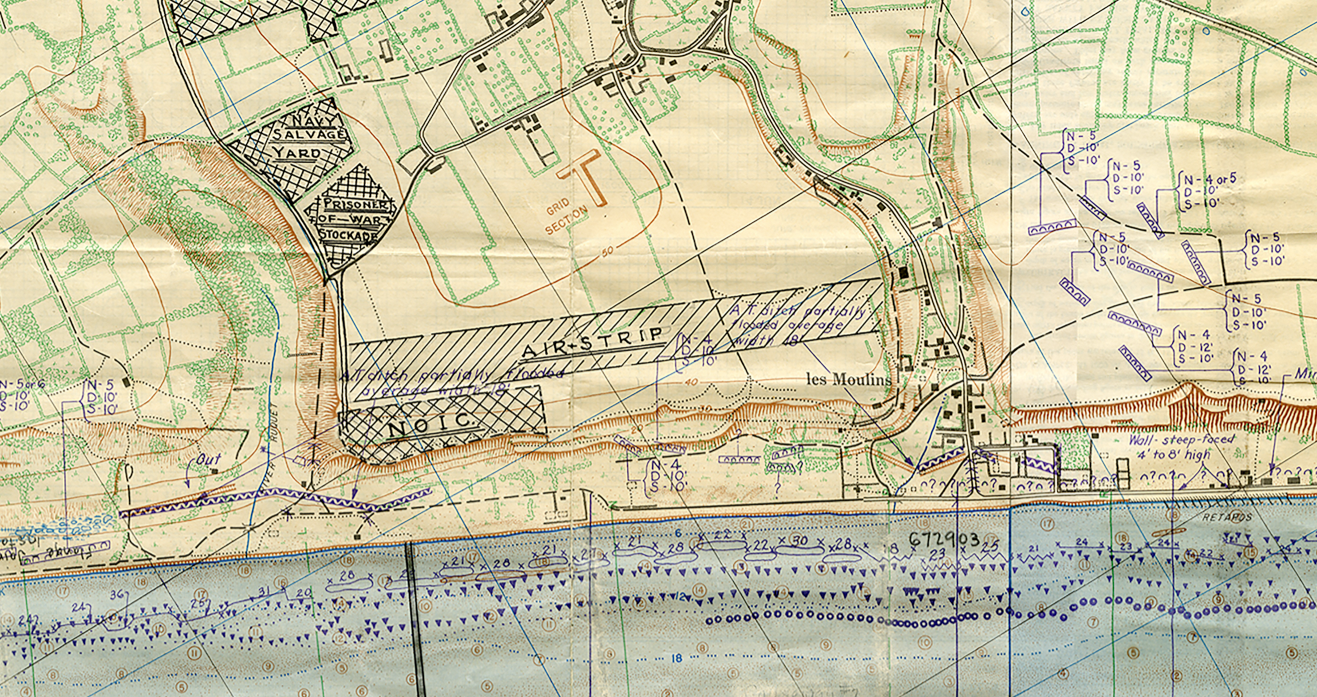
Normandy Omaha Beach Obstacle Battle Map
Operation Neptune was the initial assault phase of the Allied invasion of France on 6 June 1944 (Operation Overlord was the codename for the invasion of the entire Normandy region). The Americans stormed the beaches of Omaha and Utah, the British at Sword and Gold beaches, and the Canadians came ashore at Juno beach. Allied paratroopers had dropped behind German lines the prevent reinforcements from coming to the front as the seaborne landing troops came ashore. A successful beachhead was established which allowed for the Allies to breakout into Northwestern France in their march to Germany.
This map is a Navy Seabee map showing the obstacles on Omaha beach that the Navy and Coast Guard would need to navigate to get to the beaches.
Result: Allied Victory
Created/Published: 1944
Dimensions (Inches, Width x Height): 28x11
Our printing is archive-quality.
Each map is printed using the finest materials and methods. Your map will be handled with white gloves from start to finish. We use the Giclee printing method on the finest paper, which produces a clear, extremely detailed, durable map that is perfect to be proudly displayed in your home or office.
About our framing:
- Non-glare acrylic to reduce reflection
- Dry mount to ensure your map is smooth and without wrinkles
- 1.5 inch, 4-ply white mat to accentuate your map
- Black, light walnut, and natural frame color options to match any room
- Wire mounting
- Please note that we cannot refund or return custom framed maps. We can replace a damaged frame. If your frame is damaged, please use the Contact Us or email customercare@battlearchives.com
Digital watermark does not appear on your purchased map
Choose options
