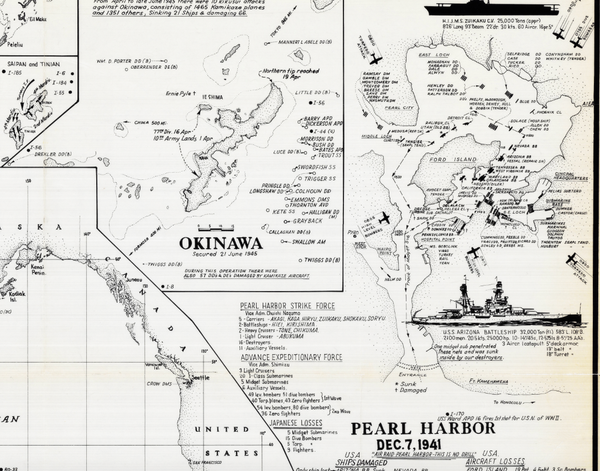
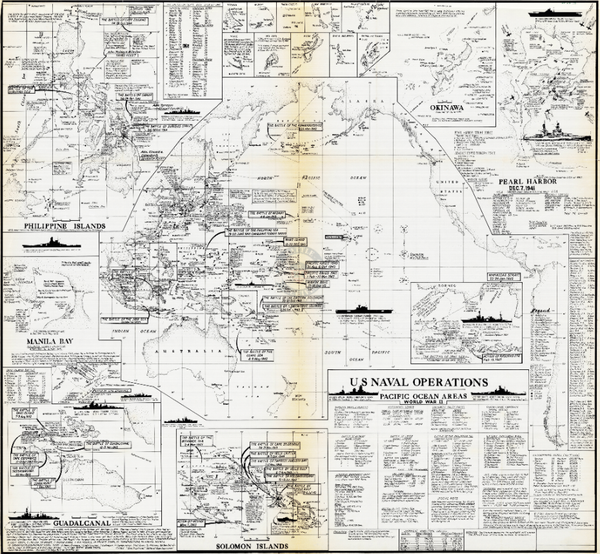
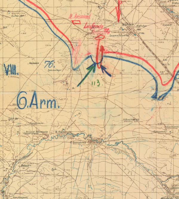
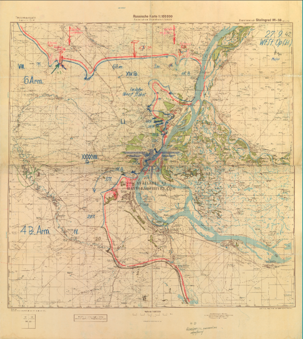
Stalingrad Topographical Map
The Battle of Stalingrad was fought from August 1942 to February 1943. Casualty estimates vary, but the Battle of Stalingrad is regarded by many as the largest and bloodiest battle in the history of warfare (other estimates put the Siege of Leningrad and Battle of Berlin at similar or larger number of casualties). The German 6th Army of Army Group South pushed to the Volga river and then were trapped by a Russian counteroffensive. Roughly 90,000 Germans surrendered on 2 February 1943. Many historians point to Stalingrad as the turning point of the Eastern front and World War II.
This map is a British map is in a series of high level maps of Europe. The large scale of this map shows the Volga river for many miles before it turns to the east after flowing through Stalingrad and the many towns and villages that would have felt the wrath of the Wehrmacht as they pushed east and eventually into Stalingrad itself.
Result: Soviet Victory
Created/Published: 1943
Scale: 1,000,000
Dimensions (Width x Height): 21x27
Each map is printed using the finest materials and methods. Your map will be handled with white gloves from start to finish. We use the Giclee printing method on Hahnemuhle paper, which produces a clear, extremely detailed, durable map that is perfect to be proudly displayed in your home or office.
Digital watermark does not appear on your purchased map.