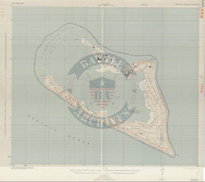


Wake Island 1942 Topographical Map
The attack on Wake Island started almost immediately after the attacks on Pearl Harbor on 8 December 1941 (Wake was on the other side of the international date line). Wake is located roughly 2,300 miles west of Honolulu. The garrison of mostly US Marines held out until 23 December before surrendering. The United States raided Wake in 1943 but were unable to take the island back until 4 September 1945, two days after the official surrender of Japan in Tokyo Bay.
Result: Japanese Victory
Created/Published: 1942
Scale: 10,000
Dimensions (Width x Height): 26.7x24.1
Each map is printed using the finest materials and methods. Your map will be handled with white gloves from start to finish. We use the Giclee printing method on Hahnemuhle paper, which produces a clear, extremely detailed, durable map that is perfect to be proudly displayed in your home or office.
Digital watermark does not appear on your purchased map.
Choose options
